

By moving around the harbour area a vessel will find complete protection from all sectors although winds from southeast round to southwest cause a groundswell that builds in rough weather. The harbour offers safe access at all tides, night or day in all reasonable weather conditions, via its well-marked primary and preferred southern entrance. Baltimore harbour may also be reached in daylight from the northwest by coming in around Heir Island and north of Sherkin Island via The Sound. Although more than workable, this requires careful pilotage between islands and rocks.


Keyfacts for Baltimore
Facilities


Nature


Considerations

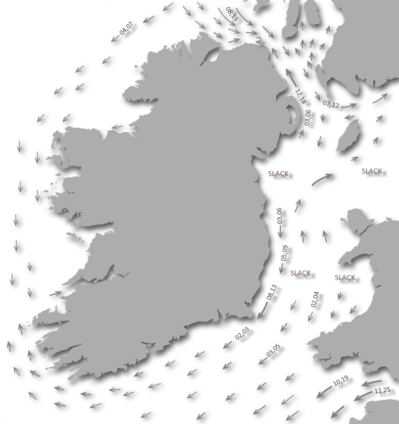
Protected sectors

Approaches

Shelter
Last modified
May 29th 2023 Summary
A completely protected location with safe access.Facilities
Nature
Considerations
 Ch.16, 09 [Baltimore Harbour Master]
Position and approaches

Expand to new tab or fullscreen
Haven position
 51° 28.975' N, 009° 22.474' W
Baltimore town pier.
What is the initial fix?
The following Baltimore Harbour initial fix will set up a final approach:
 51° 28.120' N, 009° 23.423' W


What are the key points of the approach?
Offshore details are available in southwestern Ireland’s Coastal Overview for Cork Harbour to Mizen Head  .
.
.- The primary southern entrance between Beacon Point and Barrack Point, on Sherkin Island, is readily identified by the white conical pillar Baltimore Beacon and Barrack Point's lighthouse.
- Proceed through the centre of the entrance continuing north to leave the Loo Rock marker buoy on the eastern side of the entrance, to starboard.
- Continue northward for 200 metres beyond Loo Rock mark before turning to starboard for Baltimore to stand off Quarry Rock.
- Then follow the lit lateral buoys, passing them on their correct sides, to Baltimore Port so as to pass Lousy Rock and Wallis Rock.
Not what you need?
Click the 'Next' and 'Previous' buttons to progress through neighbouring havens in a coastal 'clockwise' or 'anti-clockwise' sequence. Below are the ten nearest havens to Baltimore for your convenience.
Ten nearest havens by straight line charted distance and bearing:
- Castle Ruins - 0.9 nautical miles WSW
- Horseshoe Harbour - 1.1 nautical miles SW
- Quarantine Island - 1.3 nautical miles NW
- Kinish Harbour - 1.6 nautical miles WSW
- Turk Head - 1.6 nautical miles WNW
- Inane Creek - 1.6 nautical miles N
- East Pier - 2 nautical miles WNW
- Trá Bán - 2 nautical miles WNW
- Rincolisky Harbour - 2.3 nautical miles WNW
- Reena Dhuna - 2.5 nautical miles N
These havens are ordered by straight line charted distance and bearing, and can be reordered by compass direction or coastal sequence:
- Castle Ruins - 0.9 miles WSW
- Horseshoe Harbour - 1.1 miles SW
- Quarantine Island - 1.3 miles NW
- Kinish Harbour - 1.6 miles WSW
- Turk Head - 1.6 miles WNW
- Inane Creek - 1.6 miles N
- East Pier - 2 miles WNW
- Trá Bán - 2 miles WNW
- Rincolisky Harbour - 2.3 miles WNW
- Reena Dhuna - 2.5 miles N

Chart

What's the story here?
 Baltimore Village and Port on the eastern shore
Image: Michael Harpur
Baltimore Harbour is a sizable natural harbour that lies between Sherkin, Spanish Island and Ringarogy Islands and the mainland. It is overlooked by Baltimore village and port located on the eastern shore about ¾ of a mile northeast of the harbour entrance. The village is the main service point for the area and adjacent islands as well as a popular holiday destination in itself. The harbour is mostly used by ferries to Sherkin Island, Cape Clear Island, as well as the eastern side of Roaring Water Bay and Carbery's Hundred Isles. The port also has an active fishing fleet that principally berth alongside the north pier. In addition to this, it has a host of local recreational boats and is a busy yachting centre.
 Baltimore Village
 Image: Tourism Ireland
The most convenient Baltimore option is to take a visitor buoy by arrangement with the harbour master who will be just as delighted to advise on all berthing options
 +353 (0)87 235 1485,
  +353 (0)28 320560,
  diarmuid.minihane@corkcoco.ie, [VHF] [Baltimore Harbour Master] Ch.16 & 09. The ample buoys, usually supplied with pickup buoys, are located in the deeper water to the north of the piers making the harbour a short dinghy jaunt.
  Baltimore is a busy centre for recreational boating
 Image: Colin Park via CC BY-SA 2.0
The seasonal Baltimore pontoon, (May-Sep) on South Pier, can accommodate up to 10 yachts rafted in 2.4 metres. There are a wealth of anchorages in its wide expanse of water, especially to the north of the entrance, and its wide range of opportunities can be relied upon to provide a safe haven under virtually all conditions. There is however always a groundswell in the harbour with the wind between west by north and southeast, which increases considerably in boisterous weather. Protection from strong northwesterly conditions can be found in Church Strand Bay.
How to get in?
 The expansive Baltimore Harbour tucked in behind Sherkin, Spanish and Ringarogy Islands
Image: Michael Harpur
 Use Ireland’s coastal overview for Cork Harbour to Mizen Head for seaward approaches. The natural harbour of Baltimore is located between Sherkin, Spanish, and Ringarogy Islands and the mainland. Its primary entrance is its 'southern entrance' situated between Beacon Point and Barrack Point on Sherkin Island. The entrance is easily identified by Beacon Point's, to the east, a white conical pillar Baltimore Beacon and Barrack Point's lighthouse.
 'Lot's Wife' Baltimore – beacon white conical pillar unlighted position: 51°28.417'N, 009°23.272'W
Barrack Point – Light tower Fl.(2)W.R.6s 40m 6/3M position: 51° 28.375´N, 009° 23.670´W
 Yacht sailing in the southern entrance
Image: Francesco Crippa via CC BY-SA 2.0
The preferred, most straightforward and direct approach, night or day, is through its southern entrance and we describe this here. There is also another approach for vessels approaching from the north and west via the harbours northern entrance and The Sound. This is from the southern half of Long Island Bay but it requires careful daylight pilotage between islands and rocks.
 Boat exiting Baltimore through The Sound and approaching the River Ilen
Image: Michael Harpur
The northern entrance is however much more convenient for those approaching from Schull or Roaringwater Bay. Via this route the harbour is approached via the River Ilen and 'The Sound', should use the directions provided for Oldcourt’s
 River Ilen approach description. The Routes entry 'Baltimore Harbour North Entrance' shares a set of waypoints that may be availed of for this approach.
 Kedge Island situated about a ⅓ of a mile south of Spain Point
Image: Burke Corbett
 Vessels approaching from the east, on closer approaches, should pass well south of the 34 metres high and flat-topped Kedge Island. It is situated about a ⅓ of a mile south of Spain Point and has a chain of pinnacle rocks extending from the islet to the shore. Do not be tempted to cut in close to the island as a shallow wreck, with 1.8 metres of cover, lies 250 metres off the southern shore of Kedge Island.
Kedge Island Wreck – Unmarked position: 51° 27.630´N, 009° 20.790´W
Barrack Point lighthouse bearing fall below a bearing of the 294°T, as marked in its Red sector at night 168°-294°, clear this wreck before turning onto the initial fix.
Image: Michael Harpur
 Vessels approaching from the west will find Sherkin Island clear of dangers by standing 400 metres off its south-eastern coastline.
 The entrance to Baltimore harbour as seen from seaward
Image: Burke Corbett
 Baltimore’s narrow 400-metre wide southern entrance is not easily made out at angles from any distance as its cliffs tend to close it off. However from the Baltimore Harbour initial fix, situated a ¼ of a mile south of the Baltimore Harbour entrance, all will easily be made out.
  'Lot’s Wife' corresponding with the lighthouse on the western Barrack Point
Image: Michael Harpur
The aforementioned conspicuous white beacon at an elevation of 50 metres on the eastern Beacon Point, locally known as 'Lot’s Wife', plus the white lighthouse on the western Barrack Point, clearly point out the entrance.
 Boat exiting Baltimore's southern entrance
Image: Michael Harpur
The entrance channel is deep, with at least a charted depth of 6.2 metres, and approximately 80 metres wide, between rocky ridges extending from Barrack Point and Beacon Point. Keep well off the western side on approach. The area, to the south of the Barrack Point Light House, on the southwest side of the entrance channel, has an outcropping of rocks extending almost 150 metres south with Wilson Rock, HW 0.1 metre, awash at its southernmost point. At night it is further supported by a sectored light R. 168°-294°, W.-038°, obsc.- 168°.
 Loo Rock buoy in the north end of the entrance
Image: Michael Harpur
Proceed through the centre of the entrance continuing north to leave the Loo Rock marker, a starboard Light Buoy Fl.G.3s, on the eastern side of the entrance, to starboard. The rock is located in a north-easterly direction from the buoy, nearly one-fourth of the distance across from the eastern to the western points, and uncovers at low water spring tides.
Loo Rock – starboard buoy Fl G 3s position: 51° 28.438'N, 009° 23.458'W
 The ferry arriving at the quay at Abbey Strand on Sherkin Island
Image: Michael Harpur
Within the entrance, a conspicuous ruin of an abbey will be seen on Sherkin Island with a road leading down to the quay to Abbey Strand where the island ferry docks. A good anchorage in the separately covered Sherkin Island
, just off the slip by the ruined Abbey, is available here. Baltimore situated about ¾ of a mile northeast of the entrance
Image: Michael Harpur
The village and port of Baltimore are situated about ¾ of a mile northeast of the entrance. The area between Sherkin Island and the mainland is relatively shallow but has ample water for leisure craft. It is not without dangers with the principal rocks on the way to the port being:
- • Quarry Rock
- • Lousy Rock
- • Wallis Rock
There are other ledges of rocks in different parts of this harbour, but their proximity to the shoreline, or distance from the anchoring grounds, makes a description of them unnecessary but Admiralty chart 3725 will make these clear.
Quarry Rock is most likely to be of little concern to most leisure having 2.1 metres of cover LAT and being steep-to on the channel side. It is nevertheless unmarked and sits very much in the path of a direct course between the Loo Rock mark and the No. 1 starboard-hand mark. As such deep draught craft need to take precautions. It is located about 400 metres northeast from the Loo Rock it is best avoided by standing on northward for 200 metres beyond the Loo Rock mark before turning to starboard for Baltimore. When the North Pier and buildings come clear around the headland of Connor Point, on Coney Island, 060°T, it is safe to turn to the port buoy.
Image: Graham Rabbits
Lousy Rocks are situated a ½ mile within the entrance, and near the middle of the harbour, these rocks uncover on the last quarter ebb and dry from 0.3 to 1.5 metres. They are marked by a conspicuous 12 metres high unlit south cardinal beacon on the south-eastern rock. The ground is both foul and shallow for about 200 metres to the north and west of the perch, with Ransome Rock, with 1.8 metres of water over it, situated 220 metres westward of Lousy Rocks. The eastern side is however clear. Staying close to the No. 1 starboard-hand mark will keep a vessel well south of Lousy Rocks.
Wallis Rock is a small patch nearly midway between the Lousy Rocks and the town quays of Baltimore, slightly nearer to the former. At low water, there are 1.8 metres over it. Its position is marked on its south side by a port hand light buoy located north of the moored boats. Passing the Wallis Rock port-hand buoy on its correct side will keep a vessel well south of Wallis Rock.
 Lateral buoys and marks leading to Baltimore Port
Image: Michael Harpur
All of these rocks, with an allowance being made for Quarry Rock, may be avoided by following the lit lateral buoys and passing them on their correct sides to the port. A further No. 3 lit starboard buoy between Coney Island and the port mark the shallows of The Cove.
 Baltimore with Church Strand Bay in the backdrop
Image: Michael Harpur
The preferred anchorage is to the north or west of the north pier of the harbour in about 1.8 metres. Avoid the track of the Sherkin ferry by anchoring north of the line of the Wallis Rock port buoy and North Pier. View from the cockpit of a boat anchored in Church Strand Bay
Image: Burke Corbett
During boisterous north-westerly to south-westerly winds, the berths off of the village become uncomfortable. In these circumstances, shelter may be obtained by moving to the northeast side of the harbour, past the lifeboat slip in Church Strand Bay. Anchor according to draft and conditions clear of the channel into Church Strand Bay. The beach can be used for landing but is subject to extensive swaths of seaweed; if weather permits, a dinghy trek back to the harbour would be the best option.
 Baltimore Pier with the north pier on the left, south to the right
Image: Michael Harpur
In strong westerly’s there is a good anchorage in the separately covered haven of the Sherkin Island
, just off the slip by the ruined Abbey. The seasonal pontoon on the south pier
Image: Michael Harpur
The port itself consists of a small basin, which partly dries, between the stone quay of the North Pier and the 50 metres distant South Pier. It may be possible to come alongside the North Pier that is principally used by fishing boats. The south side of the North Pier has up to 1.3 metres and the north side of the North Pier has up to 2.1 metres. The newly refurbished South Pier’s northeast side dries to 0.5 metres at its inner end. Depths increase to 1.5 metres at the pierhead but this outer end is in constant use by the ferries.
 Baltimore's seasonal pontoon and dingy dock
Image: Olivier Bruchez via CC BY-SA 2.0
From April to September a pontoon is set in place off the west face of the South Pier and connected by a footbridge. The pontoon is small and can only caters for up to 20 yachts in 2.4 metres and has no breakwater. This is usually in very high demand during the season and cannot be relied upon for a berth.
Why visit here?
Baltimore's name, in Irish Dún na Séad, is an Anglicisation of Irish words Baile an Tí Mhóir meaning 'town of the big house'. The town's name is pronounced slightly differently than that of Baltimore in the USA, being Bal-timore rather than Ball-timore. Baltimore's name comes from its overlooking O'Driscoll castle, Dún na Séad
Image: Old Wellies via CC BY-SA 4.0
The Irish language name is derived from the O'Driscoll castle, Dún na Séad or 'Fort of the Pearls or Jewels' that overlooks the town today. The O'Driscolls were a powerful clan that once controlled the entire southwest Cork area. Their dominion stretching over the thousand square miles that lay between the Kenmare and the Bandon Rivers. After the Anglo-Norman invasion, their territory was reduced by the encroachments of the O’Donovan, O’Mahony and O’Sullivan families who were themselves being pushed westward into the coastal strip between Castlehaven and Roaringwater Bay by the Normans. Despite this, the O’Driscolls held considerable power in the area up until the 17th-century.
Image: Old Wellies via CC BY-SA 4.0
They secured their footing by building nine coastal castles and from which they maintained a blended income from harbour landing rights, fishing and opportunistic piracy. Originally erected in 1215, and later made into a fortified house, Baltimore’s Dún na Sead, was the main seat of O'Driscoll Mór - 'big O'Driscoll'. The ruins of their castles of Dún na Oir, the 'Fort of Gold', stand on Cape Clear, and Dún na Long, the 'Fort of the Ships', on the east side of Sherkin Island facing Baltimore harbour, as well as that of Cloghan Castle which lies in ruins in the middle of Lough Hyne. Baltimore’s Dún na Sead has recently been lovingly restored and it is open to the public in the summer. The ruins on Cape Clear and Sherkin Island are very much worth seeing.
 Dún na Long an Sherkin Island
Image: Jim Driscoll via CC BY-SA 2.o
The clans final undoing was to take an active part in the Spanish Landings at the climax of the Nine Years' War- a campaign by Hugh O'Neill, Hugh Roe O'Donnell and other Irish lords against English rule during the reign of Tudor Queen Elizabeth I. After the devastating defeat of the Irish forces, at the Battle of Kinsale in 1601, the property of the O’Driscolls was confiscated and given to Lord Castlehaven. The clan’s final chief, Sir Fineen O'Driscoll, the Rover, was to be the most notorious of the clan. In the first period of his reign, he supported the English rulers by confiscating Spanish ships and was knighted for his efforts in 1587. Sir Fineen eventually died lonely and destitute in 1629, after retiring to the castle in Lough Hyne.
 The restored Dún na Sead
Image: Jim Driscoll via CC BY-SA 2.o
Baltimore's history has always been dominated by the sea, so much so that an attack from the sea hindered its historic development. This was the 1631 'Sack of Baltimore' when the town was raided by Algerian pirates. In the middle of June and under the command of a Dutch captain Morat Rais, two Algerian warships working their way along the south coast seized upon two Dungarvan mackerel fishing boats off the Old Head of Kinsale. Bent on avoiding a raid on his home port the skipper of one of these boats, called John Hackett, persuaded Morat Rais Baltimore would be a better target. This they did and supported by John Hackett in the early hours of the morning of June 20th the 'Sack of Baltimore' commenced. The landing party, armed with muskets, scimitars, long knives, and tarred canvas alight on sticks, used iron crowbars to break open 40 houses and loot a further 37. They then herded 89 women and children plus 20 men captives back onto the Algerian boats. Before setting sail for Algiers they released John Hackett as a reward for his support.
 Dún na Oir, the 'Fort of Gold', the last fortification before the New World
Image: Old Wellies via CC BY-SA 4.0
The boats arrived back at Algiers on the 10th August where the captives were brought to the Bashaw's Palace. The Bashaw’s share was 15 of the captives and the others were sold on the open market. None were ever to be seen again in Ireland. Those that survived the sacking departed the harbour area and founded the town of Skibbereen. Situated about 10 miles inland it provided a more secure location for the area’s population and is today the largest town in the region. Reminders of this bleak incident appear around the town, most oddly noted in the local pub 'The Algiers Inn'. Another foreign connection, according to local myth, is that Napoleon obtained his famous white mare from the Baltimore area.
 Much of Baltimore's tourism is bases around its waters
Image: Tourism Ireland
Today Baltimore attracts many visitors from within Ireland and the population booms during the summer months. This is largely due to a large number of summer homes that have been built here in the last decade. To service these visitors the town boasts several bars, pubs, restaurants and hotels, many of them offering local seafood, and they range in style from traditional to modern. All have in common a warm welcome and a great pint. A regular feature of the pubs is live music that creates a very good atmosphere. These are enlivened by regular festivals and events held throughout the season. This series of events are heralded by Baltimore's springtime fiddle fair, followed by a seafood and jazz festival in May.
 Baltimore hosts ample festivals where good food and music can be enjoyed
Image: Tourism Ireland
Outside of this most of Baltimore's activities in and around have a maritime flavour, such as sea angling and kayaking where the West Cork coastline has a host of creeks and inlets to explore. It has also become a very popular venue for snorkelling and scuba diving, due largely to the number and variety of shipwrecks in the bay, including a World War Two submarine (the U-260). A relatively new diving attraction is the bulk carrier the Kowloon Bridge which ran aground on The Stags Rocks in 1986 whist carrying ore.
Image: Tourism Ireland
For those who want a change from water-based activities, the spectacular surrounding countryside and nearby islands have some great walks. Whether you are looking for strenuous exercise or just a quiet stroll the magnificent coastal scenery makes the perfect backdrop. The harbour's unusual large conical stone structure, the Baltimore Beacon, locally known as Lot’s Wife, is a must walk for all visitors. Used today to positively identify the southern entrance it was originally built by order of the British government after the 1798 rebellion. Then the marker was then part of a series of lighthouses and beacons dotted around the Irish coast that formed a warning system for invasion or uprising. Situated approximately a mile’s walk from the pier and supported by a road and pathway all the way, the scale of the stone beacon and the view from its situation makes it the perfect objective for a pleasant walk, especially at sunset.
 Humpback whale diving off the Stags
Image: Padraig Whooley via CC-BY 2.0
From a boating point of view Baltimore’s large natural harbour provides a safe anchorage for visiting yachts, moorings, pontoon berths plus practical shore facilities that include chandleries, marine repair services, and the all-important grocer's shop for reprovisioning. But more importantly, Baltimore is the gateway to a sailing paradise of Carbery's Hundred Isles and Long Island and Roaringwater bays. In Peter Somerville-Large's very celebrated 1928 account of his exploration of West Cork’s rugged coastline by bicycle, 'The Coast of West Cork' he began to consider he had chosen the wrong means to explore the area when he noted [this is] 'one of the best and safest sailing grounds for boats in the British Isles'. How true.
 Baltimore is the ideal point to arrive or depart into the Atlantic
Image: Michael Harpur
The surrounding sheltered waters provide scores of secluded islands, small harbours, rivers, bays and inlets and secluded hideaways that provide for a unique inshore cruising experience. Here vessels may cruise for miles without venturing into the open sea should you not want to. These waters are also a great place to view marine wildlife at close quarters thanks to the numbers of whales, dolphins and marine animals that pass close inshore off this corner. All this makes a very popular port of call for yachts cruising the southwest coast. It is also a major landfall harbour for boats arriving from England, France and Spain or indeed a place for vessels to set off on passage across the Atlantic or southward to Spain well clear of the continental shelf.
What facilities are available?
Fuel and water are available on the new pier where a summertime temporary jetty is set in place to cater for yachts. There is a chandlery and small boat yard in the area where it may be possible to leave a boat. There is one hotel, many pubs and restaurants, and showers are available at a pub adjacent to the harbour. Showers are also available when not occupied by racing competitors at Baltimore Harbour Sailing Club, situated at the head of the basin and open in the summer. A Wi-Fi service is available in the harbour area as are postal services.There are a host of pubs and restaurants in the immediate harbour area that serve a wide range of food at differing price levels. A reasonably good mini-market overlooks the harbour. The harbour also features a second sailing club, Glenans Irish Sailing Club located in the old railway station, where visitors are always welcome.
A bus service from Baltimore to the substantial provincial town of Skibbereen (approximately 10km) gives access to larger stores where a wider range of provisions are available. Ferries sail from Baltimore to Schull further along the coast, to Sherkin Island, and to the more remote Cape Clear Island. Do note that Sherkin Island also has a good pub and restaurant.
Any security concerns?
Never a security issue known to have occurred in Baltimore.With thanks to:
Burke Corbett, Gusserane, New Ross, Co. Wexford.Aerial Overview


Add your review or comment:
Please log in to leave a review of this haven.
Please note eOceanic makes no guarantee of the validity of this information, we have not visited this haven and do not have first-hand experience to qualify the data. Although the contributors are vetted by peer review as practised authorities, they are in no way, whatsoever, responsible for the accuracy of their contributions. It is essential that you thoroughly check the accuracy and suitability for your vessel of any waypoints offered in any context plus the precision of your GPS. Any data provided on this page is entirely used at your own risk and you must read our legal page if you view data on this site. Free to use sea charts courtesy of Navionics.