

Set at the head of a deep inlet and having the protection of a large island the harbour affords protection against all winds and sea. The northern approach around Whiddy island is well marked, lit making access straightforward at any state of the tide, in all reasonable conditions.

Keyfacts for Bantry Harbour


Nature


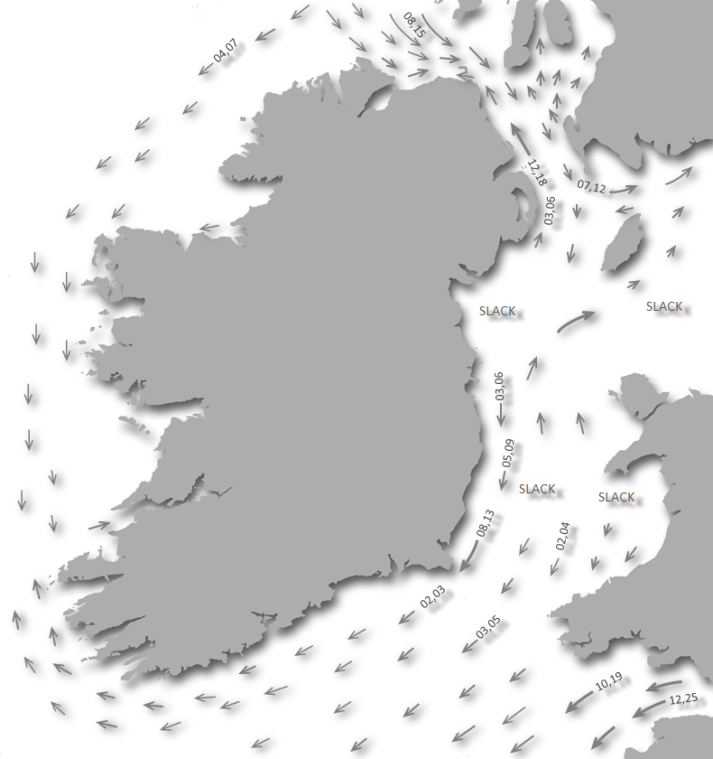
Considerations


Protected sectors


Summary* Restrictions apply
A completely protected location with straightforward access.Nature
Considerations
 +353 27 53277
 +353 87 9532777
 alec@bantrybayport.com
 bantrybayport.com/
 Ch.14
Ch.14Position and approaches

Haven position
 51° 40.921' N, 009° 27.888' W
Approximately 200 meters northwest of the harbour entrance.
What are the initial fixes?
The following waypoints will set up a final approach:(i) Bantry Harbour Eastern Approach Initial Fix
 51° 42.547' N, 009° 28.794' W
This is 300 metres north of Whiddy Point East which is Whiddy Island’s north-easternmost point.
(ii) Bantry Harbour Western Approach Initial Fix
51° 40.210' N, 009° 30.654' WThis is about 350 metres northwest of Relane Point and on the alignment 063° T of the cliff on the south side of Reenbeg Point and the high-water mark on South Beach.


What are the key points of the approach?
 .
. - The Eastern Approach is the preferred approach that is marked. The Western Approach, south around Whiddy Island, should only be used in good conditions with a leading wind or under power.
- From Whiddy Point East track to the markers into the channel.
- Leave the Horse Lt buoy, ¾ a mile southeastward, to starboard, Gurteenroe to port and then the two Chapels to starboard keeping a sharp eye out for aquaculture infrastructure.
- Proceed southward to the harbour entrance ½ distant, pick up moorings or anchor off.
Not what you need?
- Glengarriff Harbour - 4.6 nautical miles NW
- Dunbeacon Harbour - 5.2 nautical miles SW
- Dunbeacon Cove - 7.1 nautical miles SW
- Kitchen Cove - 8 nautical miles SW
- Poulgorm Bay - 8.3 nautical miles SSE
- Ballydehob Bay - 8.4 nautical miles S
- Adrigole - 9.5 nautical miles W
- Rossbrin Cove - 9.5 nautical miles S
- Dereenatra - 9.8 nautical miles S
- Schull Harbour (Skull) - 9.9 nautical miles SSW
- Glengarriff Harbour - 4.6 miles NW
- Dunbeacon Harbour - 5.2 miles SW
- Dunbeacon Cove - 7.1 miles SW
- Kitchen Cove - 8 miles SW
- Poulgorm Bay - 8.3 miles SSE
- Ballydehob Bay - 8.4 miles S
- Adrigole - 9.5 miles W
- Rossbrin Cove - 9.5 miles S
- Dereenatra - 9.8 miles S
- Schull Harbour (Skull) - 9.9 miles SSW

Chart

What's the story here?
 Bantry Harbour
Image: Michael Harpur
Bantry Harbour and town lies at the head of Bantry Bay sheltered by Whiddy Island and in the southeast corner of the harbour. The bay is a deep-water gulf extending for 30 km (19 mi) to the northwest which makes it the largest of the long marine inlets in southwest Ireland. The small harbour stands at its head in the mouth of a muddy creek, dry at low water, that leads to the market town above.
 Bantry Pier
Image: Michael Harpur
The well-protected Bantry Harbour provides shelter from all winds with a choice of berthing options. The Bantry Bay Port Company operates a 40 berth Bantry Harbour Marina in the inner harbour with ample short-stay berths. These provide convenient access to the town pier and have the following rate card
 . They also offer seven visitor moorings in the inner harbour area. The harbour offers a host of anchoring opportunities with excellent mud holding.
 Bantry Harbour Pontoon
Image: Michael Harpur
How to get in?
 Bantry Harbour tucked into the southeast end of Bantry Bay
Image: Michael Harpur
 Use southwestern Ireland’s Coastal Overview for Mizen Head to Loop Head for approaches to the area and final approaches may be made around Whiddy Island, either north around or south around.
  Whiddy Island protecting the harbour area
Image: Michael Harpur
The preferred channel is the north around called the Easter Approach that is around the northeast point of Whiddy Island. This is well marked, wide and deep. Although slightly shorter the Western Approach, south around Whiddy Island, should only be used in good conditions with a leading wind or under power. It has a bar that has its shallowest point that sometimes breaks, of 2-metres, located just seaward of the narrowest point. Also, just outside the shallow part of the bar is ominous sounding Cracker Rock that has only 1.7 metres LAT of cover. The tidal streams in the western pass also run stronger reaching 1.5 knots, whereby in comparison you would only find up to 0.5 knots in the Eastern Entrance. However, directions are provided for both approaches.
 The ruin of the offshore Whiddy Island oil terminal
Image: James Stringer via CC BY 2.0
The Eastern approach to the harbour is very straightforward but it is not without its own problems particularly at night or in low visibility. Make a note to stand well of the southwest end of Whiddy Island when making an approach at night. 500 metres offshore is the badly lit ruin of the offshore Whiddy Island oil terminal that was destroyed in 1979.
The other problem is the aquaculture that occupies the entire space off the northeastern side of the island. These floating structures, some mere lines of barrels, are low, often unmarked and sometimes hard to see. The harbour commissioners do not allow these to encroach on the fairway but they are always close by. As a result, it is not advisable to make a night entry or in very poor visibility without local knowledge.
 The Eastern approach around the north-eastern point of Whiddy Island
Image: Dzjamkokarlis via CC BY-SA 4.0
 From the Easter Approach Initial Fix Whiddy Point East may be rounded close in but all other islands in the harbour are generally foul all round, out to 300 metres in some cases. Once around the host of unlit oyster and mussel fishing rafts, as well as shrimp pots in autumn, will be seen eastward of Whiddy Island.
  The area between the Chapel Islands and Whiddy is filled with aquaculture
Image: © Trebography
Apart from avoiding the rafts, all that is required is to follow the channel markers in and then drop down on the anchorage. From Whiddy Point East track to the markers into the channel picking up and leaving the Horse Lt buoy, ¾ a mile southeastward, to starboard, Gurteenroe to port and then the two Chapels to starboard.
Horse Lt. buoy marks the channel between Horse Islet, 0.9 might high and fairly steep-to, and Gurteenroe Point.
Horse Lt. buoy - Fl. G. 6s – position: 51° 42.142’N, 009° 27.795’W
Gurteenroe Lt. buoy marks a flat, with 1.8 to 5.5 metres, that extends more than 200 metres from Gurteenroe Point, on the eastern shore, southeastward of Horse Islet.
Gurteenroe Lt buoy Fl.R.3s – position: 51° 41.841’N 009° 27.822’W
Chapel Islands, two islands joined at low water, lie in the centre of the harbour southward of Horse Island, in a northeast and southwest direction, and together are 730 metres in length and 18.3 to 18.9 metres in height. Farms lay on both sides of the islands and the western side of the fairway is marked by two starboard buoys.
Chapel Lt buoy Fl.G.2s – position: 51° 41.663’N, 009° 27.963’W
Chaple Island East Fl(2)G.10s – position: 51° 41.461'N, 009° 27.901'W
Once clear of these marks proceed southward towards the piers which will be visible ½ distant.
 The run southward from the Chapel Islands to the harbour entrance
Image: Michael Harpur
The Western Entrance initial fix is about 350 metres northwest of Relane Point and on the alignment 063° T of the cliff on the south side of Reenbeg Point and the high-water mark on South Beach. This leads to the south of Cracker Rock, which lies about 350 metres offshore on the west end of the bar, and the shallowest part of the bar.Cracker Rock – position: 51° 40.390’N 009° 30.459’W
_and_whiddy_island.jpg) The Western Entrance between South Beach (left) and Whiddy Island
The Western Entrance between South Beach (left) and Whiddy IslandImage: Michael Harpur
Approach to the south of Cracker rock by steering towards Relane Point keeping about 150 metres off the shoreline. When the south side of Reenbeg Point comes in line with the high-water mark on South Beach, follow the alignment in until it narrows. Then take a mid-channel route between the island and mainland.
 The marina pontoons immediately inside the entrance
 Image: Michael Harpur
Come alongside a berth in the marina or pick up a visitor mooring. The moorings are located in line between Bantry Pier Head and the Abbey Slipway in the Inner Harbour Bantry Bay. With permission from the HM, it may be possible to moor on the outside of the town pier, for short periods in good weather. However, this is subject to wash. Boats alongside Bantry Harbour Pontoon
Image: Michael Harpur
Anchor 400-600 metres from the pier northwest of Bantry House, east of small craft, visitors' and sailing club moorings. Keeping about 200 metres off as there is foul ground all around an old quay. The entire harbour has very good mud holding. Alternatively, anchor outside or northward of the moorings. Do not anchor by the 8.4 metres sounding that is on the track of the Whiddy Island ferry, or anywhere near it to keep clear of its wash. Land at the pontoon the west end of the Abbey slip. It has 1.1 metres at LAT and is only suitable as a temporary high water berth or for dinghy landing.
 Rabbit Island alongside Whiddy Island
Image: Michael Harpur
To escape the harbour activity it is possible to move 600 metres west and anchor outside local yachts to the northwest of Bantry House. Or alternatively, select a quieter and very protected location off Rabbit Island that lies alongside Whiddy. Anchor 200 metres southwest of Rabbit Island or 100 metres to the north in 2-3 metres as there are fisheries between Rabbit Island and Whiddy.
 The Whiddy Pontoon with Rabbit Island in the backdrop
Image: Paul Williams
It is possible to come alongside the 50-metre long Whiddy Pontoon that has 3 meters LAT. Boats are not permitted to lie at this berth, the sole purpose is for pick-up and drop-off and the maximum length of stay for any craft is 1 hour - any extension to this must be approved by the Harbour Master or authorised person. Overnight berth requests may be granted by the Harbour Master for visiting leisure craft subject to availability and fee.
It is also possible to anchor south of the ferry pier, but outside of this, the mussel boats clutter the other anchorages along this shore. The Whiddy Pontoon and the jetty close by make it convenient to land on Whiddy Island.
Why visit here?
Bantry, takes its name from the Irish Beanntraí, meaning '(place of) Beann's people'. Beann, most likely a tribal name. Battle of Bantry Bay by Adriaen van Diest.
Image: Public Domain
History runs deep here as the surrounding landscape abounds in monuments and relics from prehistoric times. Particularly Bantry that lies at the centre of one of the greatest concentrations of Stone Circles found in Ireland. These Bronze Age monuments, erected about 3,000 years ago, consist of circles of standing stones, always odd in number, and often accompanied by related Stone Pairs, Stone Rows, or Radial Stone Cairns. The people who came to settle here would have come to make use of the perfect natural harbour. As such, Bantry has a long and colourful history and strong association with the sea.
 Portrait of Theobald Wolfe Tone
Image: Public Domain
The Downe Survey maps of 1656-58 noted Black Rock, An Charraig Dhubh in Bantry Harbour where there is a disused swimming platform today. This was a large rock here that had deep water around it and was located in the south end of the harbour. It made it an ideal spot for ships to come alongside and during the 1630s, a timber pier was constructed here with a set of steps running down from the Rock. Black Rock served as the berth for ships visiting Bantry during the 17th and 18th centuries. But Bantry was still a very small settlement as a few decades later, in 1689, it was described by the Jacobite army officer and future author John Stevens as "a miserable poor place, hardly worth the name of a town", consisting of "seven or eight small houses, and some mean little cottages".
Doubtless, the officer arrived here in the aftermath of the first of two separate French incursions in the bay. Both used Bantry as the start point for the liberation of the Irish from British rule. The first of these incursions become known as the Battle of Bantry Bay. It was a naval engagement fought in May 1689, a week before the declaration of the Nine Years' War. Apart from the inshore operations at La Rochelle in 1627–28, the Battle of Bantry Bay was the first time the English and French navies had met in fleet action since 1545.
 1796 ships anchor recovered off the northeast point of Whiddy Island
Image: Tourism Ireland
The historical action involved 24 French and 19 English vessels, most were 3rd, 4th or 5th rate on both sides. The French ships sailed up the bay to provide supplies for the ill-fated attempt to restore James II to the British throne. A strong south-westerly was blowing directly into Bantry Bay aiding the arrival of the British Fleet intended on disrupting the landings. But the same wind greatly hindered departure from the confined area of the finger-shaped bay. The fleets locked in a scrappy struggle amidst the narrow confines near the beachhead on which the French were landing the supplies. The outcome of the engagement was somewhat inconclusive but the French managed to unload the supplies for James's Irish campaign and inflicted considerable damage on the English fleet as they departed. So it could be considered a French tactical success albeit they failed to follow up with any strategic gain.
 Droits de l'Homme battles the frigates HMS Amazon and Indefatigable running home
Image: Public Domain
Doubtless, it was the tactical success of this landing that would cause Bantry Bay to be chosen for the 1796 invasion led by Theobald Wolfe Tone. France and England had been at war since 1793. The First French Republic saw an invasion of Ireland would upend Britain and most particularly their naval superiority would be reduced by the loss of Ireland.
 Statue of Theobald Wolfe Tone
Image: El Gringo via CC Public Domain
However, it would be 'the invasion that never was'. As with the Spanish Armada in Elizabethan times, it was dreadful weather that confounded the enterprise. Ill faith had it that this would be one of the stormiest winters of the 18th century and the French fleet was entirely unprepared for such severe conditions. For six days the French battled against storms been unable to approach the shore without severe risk of being destroyed on the rocky coast. At times their ships were "close enough to toss a biscuit on shore" wrote Wolfe Tone bitterly in his diary of the failed mission. Losing their anchors as their chains snapped, many ships were forced to run before the wind and were scattered into the Western Approaches. Finally, with 10 of their ships lying at the bottom of Bantry Bay, the remainder of the fleet turned for home.
Today, the upper part of the town creek has been built over to form an attractive town square. Upon it is one of the anchors from the 1796 French expedition, discovered off northeast of Whiddy island, and a life-sized statue of Wolfe Tone. During the Irish War of Independence/The Tan Wars, the 5th Cork Brigade of the Irish Republican Army was very active in Bantry, and many remained during the 'Civil War' that followed. Those who died between 1920 and 1923 'In Defence of the Republic' are listed in Wolfe Tone Square. Bantry’s rich history is celebrated at the Bantry Museum, run by the Bantry Local History Society.
 Bantry House overlooking the harbour from the south shore
Image: Tourism Ireland
Whiddy Island, in Irish Oileán Faoide, was named by Vikings from the Norse Hvítøy, meaning 'white island'. One of Christianity's earliest churches was established on Whiddy, at Kilmore 'the great/big church' as well as just south of the current Bantry House estate at Kilnaruane 'the church of the Romans'. It is one of about twenty off-shore islands in Ireland which maintains a permanent resident population.
 The ruin of the offshore Whiddy Island oil terminal today
Image: Towel41 via CC BY-SA 2.0
The island was formerly home to an important oil terminal owned by Gulf Oil and was its terminus for Ireland. On January 8th, 1979 the oil tanker Betelgeuse exploded killing all 42 crew members as well as seven employees at the terminal. The jetty at the terminal was seriously damaged, but fortunately, the storage tanks were not affected. Nevertheless, 250 employees at the terminal, one of the largest employers in the region, lost their jobs. There was a significant environmental impact, and the local fishing industry was also affected. Some small tankers offload oil to the area, but no longer moor by the old oil ruin of the terminal. ConocoPhillips now maintains a Single Point Mooring (SPM) at the Whiddy Island oil terminal.
 Yacht on a mooring in Bantry Harbour
Photo: Tourism Ireland
Bantry is an important economic centre in the region. Apart from tourism, fishing is one of the main industries and, as you can imagine from all the rafts, mussels are one of its noted harvests. Every year a mussel fair is held during the second weekend in May with lots of music, street entertainment and, of course, seafood.
 Bantry House's formal garden
Image: Tourism Ireland
Bantry House, home since 1739 to the White family, the former Earl of Bantry, is situated on the slopes westward of the town and was originally dubbed 'Blackrock House' as it overlooked the original harbour pier. The estate is a popular wedding and events venue, and visitors can explore the formal garden, visit the House, enjoy a picnic basket from their tearoom, have Afternoon Tea in the Library. It provides a gracious venue for the prestigious West Cork Chamber Music Festival, a 10-day event that takes place in early July.
 Bantry Harbour provides perfect security from all winds
Image: Tourism Ireland
From a boating point of view, Bantry Harbour serves to provide perfect security from all winds and seas. For those wanting additional comforts a pontoon berth and the town a short stroll up the pier. This is the perfect location to reprovision a southwestern cruise as it has the best shopping and transport centre along this stretch of coast.
What facilities are available?
Bantry is a busy bustling holiday town offering good pubs, restaurants and hotels plus the best shopping and transport centre on this coast. Water is available on the pier also petrol and diesel, and locally there are marine engineers and some repairers.Buses are available to Cork, Glengariff, Castletownbear and (summer only) Kenmare, Killarney, and Clonakilty. Skibbereen is 30 KM away on the N71 main road.
The nearest international airport is Cork Airport. Bantry also has a small privately owned airfield called Bantry Aerodrome.
Any security concerns?
Never a problem known to have occurred in Bantry Harbour.With thanks to:
Burke Corbett, Gusserane, New Ross, Co. Wexford.Aerial overview of Bantry Harbour


Add your review or comment:
Oisin Creagh wrote this review on Aug 10th 2017:
A new marina has just been opened (August 2017) by Bantry Port Company, inside the Harbour wall, off the quayside in Bantry Harbour with up to 50 berths, and presumably a good few of these for visitors.
Average Rating: UnratedMichael Harpur wrote this review on May 21st 2018:
Thank you Oisin,
I have updated the main body of the text.
Please log in to leave a review of this haven.
Please note eOceanic makes no guarantee of the validity of this information, we have not visited this haven and do not have first-hand experience to qualify the data. Although the contributors are vetted by peer review as practised authorities, they are in no way, whatsoever, responsible for the accuracy of their contributions. It is essential that you thoroughly check the accuracy and suitability for your vessel of any waypoints offered in any context plus the precision of your GPS. Any data provided on this page is entirely used at your own risk and you must read our legal page if you view data on this site. Free to use sea charts courtesy of Navionics.