

The harbour provides a tolerable anchorage in the summer but is wide open to conditions from north-northwest round to north-northeast and subject to swell. However, if conditions are not excessive a vessel can move around the harbour to find protection from the northwest round through south to the northeast. Access is straightforward as the deep open bay has a mile-wide entrance that is clear of any outlying dangers.


Keyfacts for Smerwick Harbour


Nature


Considerations

Protected sectors


Summary
A tolerable location with straightforward access.Nature
Considerations
Position and approaches

Haven position
 52° 11.490' N, 010° 24.710' W
This is off Dún an Óir where the best shelter the harbour offers is usually found.
What is the initial fix?
 52° 13.150' N, 010° 24.000' W


What are the key points of the approach?
 .
. - The harbour is easily identified by Sybil Point and the remarkable peaks of the Three Sisters leading to the entrance.
- A central course through the mile-wide entrance and harbour is deep and free from hazards.
Not what you need?
- Ventry Harbour - 4.9 nautical miles SSE
- Dingle Harbour - 6 nautical miles ESE
- Great Blasket Island - 6.3 nautical miles SW
- Brandon Bay - 10.4 nautical miles ENE
- Cooncrome Harbour (Cuas Crom) - 14.5 nautical miles SSE
- Kells Bay - 15 nautical miles SE
- Castlegregory - 15.6 nautical miles ENE
- Scraggane Bay - 15.7 nautical miles ENE
- Cahersiveen - 16 nautical miles SSE
- Knightstown - 16.6 nautical miles SSE
- Ventry Harbour - 4.9 miles SSE
- Dingle Harbour - 6 miles ESE
- Great Blasket Island - 6.3 miles SW
- Brandon Bay - 10.4 miles ENE
- Cooncrome Harbour (Cuas Crom) - 14.5 miles SSE
- Kells Bay - 15 miles SE
- Castlegregory - 15.6 miles ENE
- Scraggane Bay - 15.7 miles ENE
- Cahersiveen - 16 miles SSE
- Knightstown - 16.6 miles SSE

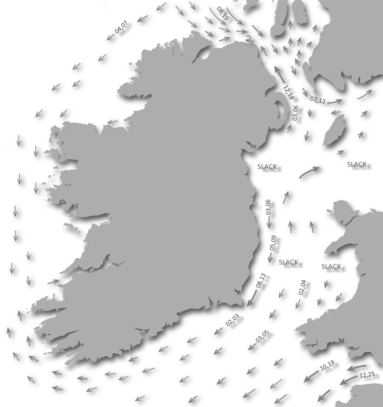
Chart

What's the story here?
 The west side of Smerwick Harbour where the best shelter can usually be found
Image: Michael Harpur
Smerwick Harbour is a large north opening bay bounded on the west by the headland of the Three Sisters, and on the east by the rising ground of Brandon Mountain. The mile-wide entrance lies between the easternmost of The Three Sisters and the 29 metres high Dunacapple Island. The harbour then holds this breath for almost 2 miles inward. It boasts a number of beautiful sandy beaches with small villages that make it attractive to tourists. It also has two piers and several slips that, along with its sandy beaches make for convenient landings.
 Slipway near the old boat harbour on the wester side of Smerwick Harbour
Image: Michael Harpur
On the chart, Smerwick Harbour looks like a perfectly sheltered haven and it is very much this in settled conditions. But outside of this, it is subject to a swell that in heavy conditions rolls around The Three Sisters and in through the wide entrance making it 'rolly'. Likewise, because its low-lying southern shore it does little to reduce strong southerly winds.
 Ballynagall Pier, locally known as Ballydavid, on the east side of the harbour
Image: Michael Harpur
For these reasons, it is neither a primary all-weather refuge nor a 'destination' harbour. Nevertheless, in the sailing season, good shelter may be had here in a variety of locations depending on the wind, by tucking inside either of the bays sheltering 'arms'.
How to get in?
 Sybil Point with Smerwick Harbour in the backdrop
Image: Tourism Ireland
 Use Ireland’s coastal overview for Mizen Head to Loop Head for seaward approaches. The position of the harbour is made unmistakable by Sybil Point which terminates in a bold precipice 206 metres high.
  Sybil Point and the Three Sisters
Image: Tourism Ireland
On its summit are the ruins of a telegraph tower, at an elevation of 126 metres. From Sybil Point, a precipitous coast leads to the entrance that presents the remarkable peaks of the Three Sisters. Rising like a row of waves to meet the sea, they are the West, Middle, and East Sisters, with the latter being the highest with an elevation of 150 metres.
 The Three Sisters as seen from the west after rounding Sybil Point
Image: Burke Corbett
Smerwick Harbour is entered between the easternmost of The Three Sisters and the 29 metres high Dunacapple Island, positioned 1-mile northeast, that forms the west point of the entrance. About 0.8 of a mile to the northeast of Dunacapple Islet is Ballydavid Head. A prominent 251-metre high conical hill, on which stands a signal tower, is situated close east-northeast of the head. Within the harbour, there are two prominent well-lit 126-metre high radio masts standing on the eastern shore.
 The eastern most of the Three Sisters
Image: Dáibhí Ó Bruadair via ASA 4.0
Do not pass between Dunacapple Island and the shore as some sunken rocks called the Black Rocks are situated at about its centre making it dangerous to attempt this passage. There are also two or three more rocks outside Dunacapple Island, one just to the west of the island, but being so close as to be almost lost in the surf that constantly breaks on this exposed shore. So it is advised to stay well clear of the islet. The western headland under the East Sister is also foul at its foot and should be given a sensible distance. Outside of this the northern approach to the mile-wide harbour is clear and deep.
 Dunacapple Island with the Black Rocks showing
Image: d_marino2001 via CC BY 2.0
 The Smerwick Harbour initial fix is set just outside the mile-wide entrance. From a depth of 50 metres here the bay gradually shoals to its head, a distance of two miles to the south, and is quite free from hidden danger throughout. The rock to make note of is Carrignakeedu which is awash at low water and lies 200 metres out from the easter side of the bay, about a ½ mile northward of Ballynagall and offshore of Bull Creek.
 The entrance to Smerwick Harbour as seen from its western side
Image: Michael Harpur
A common Smerwick Harbour error for visiting vessels is to anchor near the middle, where the holding ground is bad and exposed to the north. The best protection from the prevailing south-westerlies may be found anchored close to the west side of the bay.  Smerwick Harbour as seen from the Three Sisters
Image: Dáibhí Ó Bruadair via ASA 4.0
Being entirely open to the north and a large wide open bay it can be susceptible to rolls elsewhere. Worse, in the south round to east portions of the bay, the swell tends to wrap around The Three Sisters headland and end up at right angles to the prevailing wind. In all but very settled conditions, this makes for a rolly night in any of these locations.
 The west side of Smerwick Harbour under Dún an Óir
Image: Michael Harpur
As such the most comfortable anchorage is abreast of Smerwick village in the area called Smerwick Roads. This is close to the west shore, ¾ of a mile south of the East Sister overlooking the entrance, where good holding in mud will be found.
 The beach in the southwest corner of Smerwick Harbour
Image: Michael Harpur
An attractive anchorage can be found a little further southward off the first little beach on the west side before coming to the old boat harbour at Ballinrannig. Although the harbour holding ground is mostly indifferent there is sand here with good holding with a slip to land on the north side of the beach. There are no facilities ashore, save for a guest house near the slip and Dún an Óir is a short walk from here.
 Ballynagall known locally as Ballydavid
Image: Michael Harpur
At the opposite, east side of the harbour, there is the small village of Ballynagall that is known locally as Ballydavid. It has a new pier that extends out from rock into sand with a floodlight and a light at its head, Fl.R.3s 4m 3M.
 Ballynagall Pier at low water
Image: Michael Harpur
Depths of 0.5 metres at low water springs are available at the outer end and it provides some measure of shelter from northwest winds and swell. However, due to the groundswell, it would only be practical to come alongside in settled conditions and berth temporarily at high water.

 Ballynagall Pier
 Image: Michael Harpur
There were four visitor moorings available just south of Ballynagall Point. These moorings may have fallen into disrepair as they have not been maintained by Kerry County Council for several years. The lack of upkeep has meant that three of these moorings are now gone and all that remains is a single unmaintained mooring. No one should rely on this mooring.
 Yacht anchored off Ballynagall Pier
 Image: Michael Harpur
In southerly winds an anchorage to the south of the bay to the west of Carrigveen in about 2.5 metres with good holding in sand. The small Dunacapple Islet, with its sunken rocks lying between the islet and the shore on the east side of the entrance, partially protect the harbour from northeast winds. In moderate to strong northeast to easterly conditions shelter may be however be found tucked into the small bay at the northeast corner of the harbour.
 The old Pier in the northwest corner of the pier
Image: Google
This is located to the south of Ballydavid Head off the mouth of the Feohanagh River. This river is more or less only a stream that enters the head of the little bay through a marsh. Anchor in the middle of the bay in approximately 6 metres LAT as further inshore there is Carrigduff Reef, reportedly further out than charted, and isolated boulders that extend out to the 4-metre contour. Land at Dooneen Pier, otherwise known as 'the old pier', situated on the south side of the bay.
Why visit here?
Smerwick was originally known to the Irish as 'Muirbech', a term used for a 'breakwater' or 'a level strip of land along the coast'. It was given the completely new name of Smerwick by the Vikings, which is derived from 'smörvík' 'butter bay', most likely referring to the fertile monastic farmlands lying around it. This name was subsequently loaned into the English language. However, and although denoted as Smerwick on charts today, the area is now officially known by the Irish name 'Ard na Caithne', meaning 'height of the arbutus' or 'strawberry tree'. Technically the name Smerwick lost all legal standing under the 2004 Place Names Order that was applicable to Gaeltacht Regions. Caithair Na BhFionnurch near Ballydavid overlooking Smerwick Harbour
Image: Tourism Ireland
The Vikings gave it their name because the south and east of Smerwick Harbour they encountered had long been a cradle of early Christian civilisation. This dated back to the late 6th and early 7th centuries and countless archaeological remnants of this and later periods can be found here. At Carrigveen, with a large collection of beautifully inscribed stones, is the An Riasc monastic site that is believed to date from the 5th or 6th Century.
 Gallarus Oratory
Image: Tourism Ireland
The early Christian Gallarus Oratory, now with its Visitor Centre, was built between the 7th and 8th centuries and is the best-preserved early Christian church in Ireland. Kilmalkedar Church, the most important Christian site on the Dingle Peninsula, was built in the 12th century on the site of a 7th-century monastery founded by St Maolcethair.
 Kilmalkedar Church
Image: Robashaw via ASA 4.0
Of all of these ecclesiastical sites, it is the Iron Age Promontory fort overlooking the best anchorage on the western shore, Dún an Óir, Irish for the 'Fort of the Gold', that has the most resounding and bloodiest of tales to tell. It is a natural headland defended by man-made ramparts on its landward side and by the sea on the other three sides. The site may have been defended for the first time in the Iron Age, 500BC to 500AD or the Early Medieval period 500AD to 1170AD. Its principal battle comes from the 1500s when it was the site of the Siege of Smerwick.
 Dún an Óir
Image: Michael Harpur
The tale commences in July 1579 when three Spanish ships under the command of James Fitzmaurice, son of the Earl of Desmond, landed in Dingle. This initiated a revolt against English rule called the second Desmond rebellion. Within a week Fitzmaurice was slain in battle but he had by then unleashed a war that lasted three years. The remnants of his small initial force were then forced to over-winter with a handful of local Irish rebels at Dún an Óir overlooking the west side of the harbour.
 Dún an Óir as seen from the northwest
Image: Michael Harpur
On the 10th September 1580, a following expeditionary force of 400 - 500 Spanish and Italian Papal soldiers, commanded by the mendacious and inept Italian captain Sebastiano di San Giuseppi landed in Smerwick to reinforce the first expedition. At first, they controlled the immediate area and as he waited for the anticipated thousands of Irish reinforcements Sebastiano di San Giuseppi even hanged a few of the English messengers sent to meet them. The Irish rebels Desmond, Baltinglass and John of Desmond made an effort to link up with the expeditionary force but English forces under the Earl of Ormonde, Thomas Butler, and the lord deputy of Ireland, from 1580 to 1582, Lord Deputy Lord Grey blocked them. Only 17 soldiers would finally arrive and with them the start of Ireland’s winter season of wet, dark, and cold. With it and unfamiliar food, illness soon ensued.
 Dún an Óir and its additional defences as seen from the southwest
Image: Michael Harpur
Prompt naval action by an English naval squadron under William Wynter had blockaded the Papal force’s ships in the bay and took them. This left San Guisseppi with no choice but to retreat to the natural strongpoint that the old iron age Dún an Óir offered. They hastily strengthened defences and the well-armed defenders saw off some initial attacks by Ormonde. The three largest ships of the naval squadron then carried out a primary bombardment from their decks while three smaller vessels sailed close to shore and subjected the encampment to a lesser assault. On November 5th, a naval force led by Richard Bingham arrived to replenish Grey's supplies and landed 8 heavy naval artillery pieces. Two days later, on November 7th, Grey arrived at Smerwick with 800 troops and laid siege to the garrison. The invading forces were then entirely geographically isolated, cut off by Mount Brandon on one side and the much larger English force on the other with their backs to the sea.
 1500s depiction of the English attack on Spanish and Italian forces at Smerwick
Image: Public Domain
The English forces began the artillery barrage on Dún an Óir on the morning of November the 8th. This rapidly broke down the improvised defences of the fort. After a three-day siege, entirely cornered by the English forces and outgunned, di San Giuseppe saw that it was pointless to continue. Things came to their natural culmination on November 9th when the English landed a force of soldiers near the camp and a brief battle began. By four o'clock the defeated Italians raised a white banner as they saw surrendering as the only viable option.
 1910 depiction of Dún an Óir defences
Image: Michael Harpur
The English forces first secured the treasures and guarded the armaments and supplies. Then, according to Grey's own account… "then put I in certain bands,", two teams, one under the renowned Sir Walter Raleigh and another under a no lesser Renaissance luminary and poet, Edmund Spenser, "who straight fell to execution. There were six hundred slain." Over the course of the following two days, the captives, which included a pregnant woman, were all lined up in a nearby field and, one by one, decapitated. Some of the bodies were used for target practice, but most were tossed into the ocean. The collected heads were then buried in the adjacent field.
 View out over Smerwick Harbour from Dún an Óir
Image: Michael Harpur
Only 13 men of higher rank were spared the sword, as Grey ostensibly noted… "Those that I gave life unto, I have bestowed upon the captains and gentlemen that hath well deserved... " But this was only because they were likely to be ransomed. This small episode in the continuing conflict between Elizabeth II England and Philip II Spain was to set the stage for a much greater assault on England by a Spanish Naval force in 1588.
 The southern rear embankment today
 Image: Michael Harpur
Edmund Spenser, who was Grey’s secretary, later vigorously defended his employer’s actions against later criticism. Grey rewarded Spenser’s service with a gift of 162 pounds and a free appointment to the lucrative post of clerk of faculties in the Irish chancery in 1581. Three decades later, when Raleigh had fallen from favour, his involvement with this massacre was brought against him as a criminal charge in one of his trials. Raleigh argued that he was… "obliged to obey the commands of his superior officer" but he was unable to exonerate himself. He was executed on 29 October 1618, chiefly for his involvement in the Main Plot.
 Monument standing over when the heads were buried
Image: Michael Harpur
The field of the beheadings became known locally in Irish as 'Gort a Ghearradh', the 'Field of the Cutting', and a monument stands today where the heads were buried. The flat earthen platforms we see on the promontory today are the remains of unfinished bastions; the small rectangular embanked areas near the edge of the promontory are the sites of garrison buildings. In the early years of the 21st Century following coastal erosion, many skeletons have been revealed. The old fort is now a scramble due to erosion and soon will be isolated but the field embankments and fosse can still be seen above a short walk from the car park. A memorial to the executed stands in the bay today.
 Sybil Point and The Three Sisters was the first landmark Charles Lindbergh saw
Image: Tourism Ireland
In 1927 the adjacent natural land formation of Sybil Point and The Three Sisters would come to play a part in the advancement of science and human endeavour. They were the first geologic feature that the almost exhausted Charles Lindbergh would sight on his epic solo trans-Atlantic flight. Their unique signature, which had for centuries, guided mariners provided the key landmark he needed to secure his achievement.
 View over the south end of the harbour from Ballynagall Pier
Image: Michael Harpur
Today, Smerwick Harbour is thought to be the most beautiful in all of Cork and Kerry. Likewise bounded by the villages of Baile an Fheirtéaraigh, Baile na nGall the area is what has been known as the Fíor-Ghaeltacht, or true Gaeltacht, where the Irish language is spoken by everyone. This provides this remote area with not only a great beauty but with local people having a special and unique charm. It is truly a haven for hikers and anyone who has any interest in ancient Irish culture.
 In fine weather a glorious cruising ground
Image: Tourism Ireland
From a boating perspective, Smerwick Harbour is an ideal coastal stepping stone that it was when it was frequented by Viking shipping a millennium ago. One of the continent's westernmost anchorages it is unmistakably identifiable, a short distance from the seaways, easy of access and not restricted by any state of tide. This makes it an ideal staging point to get set up for an early tide through Blasket Sound and for a north going vessel, having made a late passage through the sound, it provides a useful setup point for a timely departure to the Arran Islands. Likewise, in a fine spell of weather, it makes a glorious cruising ground of itself with a shoreline that is steeped in interest.
What facilities are available?
There are few facilities on the west side. About a 2 km walk from the southwest anchorages there are shops, restaurants and pubs at Ballyferriter. Ballynagall has a shop with some fresh provisions, a pub and a bus service which are all a short walk from the pier. The No. 277 runs twice a day from Dingle to Ballydavid on Tuesdays and Fridays. At Carrigveen there is petrol beyond the sandhills. Dooneen Pier has a restaurant close by.Any security concerns?
Never a problem known to have occurred at this remote location.With thanks to:
Burke Corbett, Gusserane, New Ross, Co. Wexford.A view over the harbour


Add your review or comment:
Conrado Beltran wrote this review on Jan 23rd 2014:
First of all, congratulations for such an interesting information. But, I am afraid that there is a big mistake in this article.I have just read: "a following expeditionary force of 400–500 Papal soldiers, Spanish, Italian and Basque". My dear friends, Basque people are Spanish people. No doubt, this mistake is owing to the propaganda of Basque terrorists. What a shame!
Average Rating: UnratedMichael Harpur wrote this review on Apr 26th 2022:
Hi Conrado,
Managed to correct that and add some images I took this summer. Thanks for pointing that out.
Please log in to leave a review of this haven.
Please note eOceanic makes no guarantee of the validity of this information, we have not visited this haven and do not have first-hand experience to qualify the data. Although the contributors are vetted by peer review as practised authorities, they are in no way, whatsoever, responsible for the accuracy of their contributions. It is essential that you thoroughly check the accuracy and suitability for your vessel of any waypoints offered in any context plus the precision of your GPS. Any data provided on this page is entirely used at your own risk and you must read our legal page if you view data on this site. Free to use sea charts courtesy of Navionics.