
=.jpg)
The island offers an exposed anchorage with good holding that can be used in fine settled conditions. Careful navigation with good visibility is required as there is a rock in the middle of the bay off the beach. However, it is possible to anchor outside of this and the island's clear translucent waters make it east to identify it and eyeball in if required.

Keyfacts for Illauntannig
Facilities
None listedNature


Considerations
Protected sectors

Approaches

Shelter
Last modified
May 6th 2022 Summary
An exposed location with careful navigation required for access.Facilities
None listedNature
Considerations
Position and approaches

Expand to new tab or fullscreen
Haven position
 52° 19.676' N, 010° 0.950' W
Off the farmhouse about midway between Reennafardarrig and the conjoined islets of Illaunturlogh and Minnaun.
What is the initial fix?
The following lllauntannig Initial Fix will set up a final approach:
 52° 20.006' N, 010° 0.404' W


What are the key points of the approach?
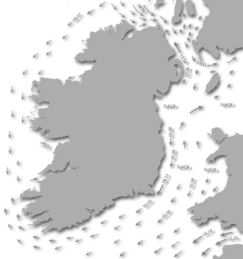
Offshore details are available in southwestern Ireland’s Coastal Overview for Mizen Head to Loop Head  .
.
. - Approach from the northeast.
- Sound into 3 metres midway between Reennafardarrig and the conjoined islets of Illaunturlogh and Minnaun.
- Beware of a bank of foul ground with Thurran Rock (often called Wheel Rock) that dries to 2.5 metres.
Not what you need?
Click the 'Next' and 'Previous' buttons to progress through neighbouring havens in a coastal 'clockwise' or 'anti-clockwise' sequence. Below are the ten nearest havens to Illauntannig for your convenience.
Ten nearest havens by straight line charted distance and bearing:
- Scraggane Bay - 1.2 nautical miles SSW
- Castlegregory - 3.9 nautical miles S
- Barrow Harbour - 5.6 nautical miles ESE
- Brandon Bay - 6.3 nautical miles SW
- Fenit Harbour - 6.7 nautical miles ESE
- Dingle Harbour - 14.9 nautical miles SW
- Kilbaha Bay - 15.5 nautical miles NNE
- Ross Bay - 16.3 nautical miles NNE
- Smerwick Harbour - 16.7 nautical miles WSW
- Ventry Harbour - 18.1 nautical miles SW
These havens are ordered by straight line charted distance and bearing, and can be reordered by compass direction or coastal sequence:
- Scraggane Bay - 1.2 miles SSW
- Castlegregory - 3.9 miles S
- Barrow Harbour - 5.6 miles ESE
- Brandon Bay - 6.3 miles SW
- Fenit Harbour - 6.7 miles ESE
- Dingle Harbour - 14.9 miles SW
- Kilbaha Bay - 15.5 miles NNE
- Ross Bay - 16.3 miles NNE
- Smerwick Harbour - 16.7 miles WSW
- Ventry Harbour - 18.1 miles SW

Chart

What's the story here?
 Illauntannig and the conjoined islets of Illaunturlogh and Minnaun
Image: Michael Harpur
Illauntannig is the largest of The Magharee Islands a group of small isles that lie to the north of the sandy peninsula that separates Bandon and Tralee Bays. The group, which are also known as the Seven Hogs, are uninhabited although Illauntannig has a dwelling house that is rented out in the summer. Illauntannig also has a monastic site comprising beehive huts, the ruins of an old church and a stone cross overlooking the anchorage. Scraggane Pier is the nearest landing point on the mainland.
 Currach moored out in the marked anchorage and a shoal draft yacht off the beach
Image: Burke Corbett
The anchorage offers 2 to 3 metres about 300 metres off of the beach below the dwelling house. Moderate draught vessels can work their way in closer and anchor off the beach.
How to get in?
 The western Magharee Islands as seen southwest
Image: Loz Pycock via CC ASA 4.0
 Use Ireland’s coastal overview for Mizen Head to Loop Head for seaward approaches. The Magharee Islands lie to the north of the sandy peninsula that separates Bandon and Tralee Bays.
  Illauntannig as seen from Scraggane Pier at the head of the peninsula
Image: Michael Harpur
The 19 metres high Gurrig Island, the westernmost and highest of the group, and the two adjacent islands of Inishtooskert, 14 metres high, and Illaunimmil, 20 metres high, are all clear of hidden dangers with deep water all round.
 Gurrig Island, Inishtooskert and Illaunimmil
Image: Michael Harpur
The 10 metres high Illaunboe, situated close northwest of Illauntannig, is joined at low water to Illauntannig as is the 13 metres high Reennafardarrig to the northeast. The pass between Illaunimmil and Illaunboe is deep, more than a ½ mile wide and clean save for an easily avoided reef that has 0.3 metres LAT of cover extending 300 metres out from the southwest end of Illauntannig. Illauntannig is 7 metres high, the largest of the islands and is clear to the south at a sensible distance.
 Illaunboe, Illauntannig, Reennafardarrig and with Illaunturlogh and Minnaun to
the right
Image: Superbass via CC ASA 4.0
The conjoined islets of Illaunturlogh and Minnaun lie to the east of Illauntannig and Mucklaghbeg lies a ½ mile eastward of these islets with good depths to pass between them.
_illaunturlogh_and_minnaun.jpg) Mucklaghbeg (left in the distance), Illaunturlogh and Minnaun
Mucklaghbeg (left in the distance), Illaunturlogh and MinnaunImage: Burke Corbett
 Approaches from the northward are clear save for some breakers which would only occur in conditions when the island's anchorage would not be usable.
  Illaunboe, Illauntannig, Reennafardarrig, Illaunturlogh, Minnaun and Mucklaghbeg
with Doonagaun in the foreground
Image: Superbass via CC ASA 4.0
 From the south use Navigating through Magharee Sound south of the Islands and then break off north between the conjoined Illaunturlogh and Minnaun to the west and the shallows off Mucklaghbeg to the east towards the initial fix.
  Reennafardarrig with a currach on moorings in the anchoring area
Image: Burke Corbett
 From Illauntannig Initial Fix steer a course of about 237°T steering in to the north of Minnaun for the anchorage where local boat moorings should be seen.
  Yacht anchored off the beach
Image: Mark Murray
Anchor according to draft and conditions east by northeast of dwelling house according to draft. 3 metres will be found about midway between Reennafardarrig and the conjoined islets of Illaunturlogh and Minnaun. Keep a sharp eye out for several small difficult-to-see mooring buoys, some of which have floating ropes attached.  Yacht anchored off the beach with Minnaun behind and Mucklaghbeg in the backdrop
Image: Burke Corbett
It is possible to continue in (also enter/exit to the south on the rise) by circumventing the principal central danger between the islets. This is a bank of foul ground almost connected with Illaunturlogh and Minnaun on its southeastern side. The bank includes Thurran Rock (often called Wheel Rock) that dries to 2.5 metres at low water on its southwestern end of the bank which on that side is steep.
Image: Burke Corbett
Thurran Rock shows at half tide and even if covered the rock and bank should be visible in the clear waters. The point of Loop Head (15 miles distant) on the eastern point of Reennafardarrig provides a sightline that cuts close but clear of Thurran rock's steep-to western side in 1 to 2 metres LAT. Keeping one hundred metres off Illauntannig also clears it. Rounding the bank and Thurran allows shallower draft vessels to anchor right off the beach halfway between the monastic settlement and the dwelling-house. Good sand holding will be found here in two metres.
Landing is easy at the steep, sandy beach on the east side of the island.
Why visit here?
The Magharee islands, in Irish, 'Oilehin an Mhachaire' from the Irish 'na machair' which means a cultivated coastal raised dune system. More precisely, one immediately inside an exposed sandy beach, behind which there is often a flat grassy area all of which perfectly describes Illauntannig. The islands are also known in English as the Seven Hogs 'Na Seacht gCeanna' although they are made up of eight islands: Gurrig, Inishtooskert, Illaunimmil, Illaunboe, Illauntannig, Reennafardarrig, Illaunturlogh and Mucklaghbeg. Of these only Illauntannig, the largest of the group, is of any standing. Illauntannig's monastic site as seen from the water
Image: © Marinette Romico
Illauntannig, Irish 'Oileán tSeanaigh', acquired it’s named after Saint Senach who reputedly founded the early Christian monastery on the island in the 7th-century along with another on Kilshannig on the mainland. The dry stone remains are substantial and situated on the east side of the island overlooking the anchorage. Thick, curving cashal walls enclose a small complex of monuments. Facing the entrance into the enclosure is the principal oratory (a small church). The oratory is rectangular, built entirely without mortar and is entered from the west with an altar built against its east wall. The second oratory, to the east, is incorporated into the monastery wall and also entered from the west. Quartz pebbles set into the wall above the doorway may originally have formed a cross.
 The monastery site as seen from above
Image: Mark Murray
In addition to these are three circular shaped stone beehive houses, or 'clocháns', which were the home of the monks, the largest of which is directly in front of the oratory. There are also three 'leachts' (stone-lined or stone-built platforms) which may be altars or covers for the graves of early abbots of the monastery. These were used as stops for prayer by pilgrims to the island in the past. Beside one of the platforms is a 1.8 metres high stone cross with bevelled edges albeit undecorated. All of this is connected by a well-preserved souterrain (underground passage) about forty metres leading into the central site inside the monastery wall. In the 19th century, a small bronze-coated sheet iron handbell was discovered inside a recess of one of the monastery walls. It is now displayed in the National Museum of Ireland.
 The circular shaped beehive houses, or 'clocháns'
Image: Burke Corbett
All of this is preserved largely because it is a remote island and uninhabited although Illauntannig and Illaunimmil, were inhabited until the early 1980s. The only dwelling is the farmhouse with outhouses which can be rented out on a weekly basis from April to September. And this is basic, water from a hand-pumped well and no electricity with oil lamps used for lighting. Outside of that, the privately-owned island is used for grazing sheep and cattle during the summer months by several local farmers.
 The 1.8 metres high stone cross
Image: Burke Corbett
Up until recently, it was common to see farmers on outlying islands load their cattle into small boats, often at this time traditional skin covered currachs, moving cattle and sheep back and forth. If distances were not too great, they would swim them over to the islands at low tide with the farmers rowing alongside them inside Currachs. Cattle are good swimmers but their heads drop down when they get tired so they drown easily. If an animal got into difficulty it was hauled aboard or tied to a boat, or sadly left to drown if it could not be rescued. Nowadays, a modified wooden pen large enough to hold two cows, about 12 feet long and 5 feet wide, built on top of empty oil barrels, is towed behind a boat making these crossings much less taxing for the animals and their owners alike.
 The dwelling house on Illauntannig
Image: Terry Ballard via ASA 4.0
The opportunity to experience the remarkable monastic settlement, the domain of boaters, makes a visit here very much worthwhile. The site is now a national monument with an information plaque sited on the approach that provides more details of the history. The sequestered island also teems with birds and other wildlife. Being generally quite flat and grassy making it ideal for Oyster Catcher and Tern (mostly Arctic) to nest. The surrounding waters have incredible underwater visibility that offers excellent snorkelling and diving. Basking Shark and Blue Shark are reputed to be common in these waters in the summer months. Its two small adjoining islands, Illaunboe and Reennafardarrig, can be reached by foot from Illauntannig at low tide, but make sure you know exactly what the tide is doing for fear of being cut off.
 View over Reennafardarrig from a boat anchored off the beach
Image: Burke Corbett
From a boating perspective, if you are daunted by the prospect of getting onto the Skelligs, or splitting the crew to have a member watch the boat hove-too, then the Illauntannig monastic site is the lazy answer to getting an idea of what remote monastic settlements are like. Illauntannig is also an ideal passage anchorage to sit out an unfavourable tide when bound for the Shannon estuary. Being only 5½ miles from Kerry Head it is the closest anchorage and avoids having to go all the way to Fenit and out again.
What facilities are available?
NoneAny security concerns?
No incident known to have occurred at this remote anchorage.With thanks to:
Burke Corbett, Gusserane, New Ross, Co. Wexford.Aerial views of Illauntannig (i)
Aerial views of Illauntannig


Add your review or comment:
Please log in to leave a review of this haven.
Please note eOceanic makes no guarantee of the validity of this information, we have not visited this haven and do not have first-hand experience to qualify the data. Although the contributors are vetted by peer review as practised authorities, they are in no way, whatsoever, responsible for the accuracy of their contributions. It is essential that you thoroughly check the accuracy and suitability for your vessel of any waypoints offered in any context plus the precision of your GPS. Any data provided on this page is entirely used at your own risk and you must read our legal page if you view data on this site. Free to use sea charts courtesy of Navionics.