

Good shelter is provided in southwest round through west to northwest outside, and smaller vessels will find very good protection inside. There is, however, an uncomfortable surge in anything from a force three from northeast round to southeast, and particularly so on an easterly. Access is straightforward in daylight as there are no offshore obstacles. The inner harbour is accessed by passing between two closely spaced pierheads and a long channel that, in most circumstances, presents little concern. However, the helm must be entirely confident in handling the vessel in a confined space.


Keyfacts for Courtown Harbour
Facilities


Nature


Considerations


Protected sectors

Approaches

Shelter
Last modified
December 9th 2020 Summary* Restrictions apply
A good location with straightforward access.Facilities
Nature
Considerations
 +353 55 25307
 courtownsailingclub.com/
Position and approaches

Expand to new tab or fullscreen
Haven position
 52° 38.629' N, 006° 13.332' W
This is the anchoring area to the north of the harbour entrance.
What is the initial fix?
The following Courtown initial fix will set up a final approach:
 52° 38.567' N, 006° 12.667' W


What are the key points of the approach?
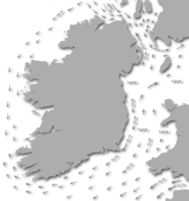
Offshore details are southbound vessels are available in eastern Ireland’s coastal overview for Dublin Bay to Rosslare Harbour  .
.
. - Keeping a ¼ of a mile offshore clears all dangers in the vicinity of Courtown Harbour.
Not what you need?
Click the 'Next' and 'Previous' buttons to progress through neighbouring havens in a coastal 'clockwise' or 'anti-clockwise' sequence. Below are the ten nearest havens to Courtown Harbour for your convenience.
Ten nearest havens by straight line charted distance and bearing:
- Cahore (Polduff) - 4.5 nautical miles S
- Arklow - 9.5 nautical miles NNE
- Wexford Harbour - 20.2 nautical miles SSW
- Wicklow Harbour - 21.5 nautical miles NNE
- Rosslare Europort (Rosslare Harbour) - 23.8 nautical miles S
- Rosslare Bay (or South Bay) - 23.9 nautical miles S
- Ballytrent - 26.1 nautical miles S
- Carne - 27 nautical miles S
- New Ross Marina - 30.7 nautical miles WSW
- Greystones - 31 nautical miles N
These havens are ordered by straight line charted distance and bearing, and can be reordered by compass direction or coastal sequence:
- Cahore (Polduff) - 4.5 miles S
- Arklow - 9.5 miles NNE
- Wexford Harbour - 20.2 miles SSW
- Wicklow Harbour - 21.5 miles NNE
- Rosslare Europort (Rosslare Harbour) - 23.8 miles S
- Rosslare Bay (or South Bay) - 23.9 miles S
- Ballytrent - 26.1 miles S
- Carne - 27 miles S
- New Ross Marina - 30.7 miles WSW
- Greystones - 31 miles N

Chart

What's the story here?
 Courtown Harbour
Image: Michael Harpur
The village of Courtown is located around its small harbour. With an attractive canal-like entrance, a pretty inner basin and 2 miles of Blue Flag beaches extending north and southward, Courtown has been a popular holiday resort for well over a century.
Good shelter can be found for deeper and larger vessels from southwest, through east, round to northwest, anchored in depths of 5 to 7 metres 400 metres seaward of the pierheads. Shallower vessels can come inside where very good shelter will be found.
The channel is dredged regularly in the summer to 1 metre LAT but this may vary after heavy onshore winds and between sweeps. For instance, when it is scarcely dredged during the winter the draft reduces to about 0.5 metres LWS or less especially so after heavy easterly winds so it is advisable to take this as a conservative estimate. Visitors can come alongside the walls in the southern half of the harbour inside the basin. The harbour is a public amenity with free berthing available alongside the wall.
How to get in?
 Courtown Harbour lies about midway between Cahore Point and Kilmichael Point
Image: Michael Harpur
 Use eastern Ireland’s coastal overview for Dublin Bay to Rosslare Harbour for seaward approaches. The small harbour of Courtown is situated 5 miles to the northeast of Cahore Point and about midway between it and Kilmichael Point. It lies at the head of a 2-mile deep bay that is generally rocky and of moderate elevation.
  The entrance from seaward
Image: Michael Harpur
 From the initial fix come directly west and locate the two pierheads. A yellow Outflow Buoy will be seen moored off the harbour.
Courtown Outflow Buoy – Yellow Buoy Fl Y 10s position: 52° 38.437’N, 006° 12.975’W
Those entering the basin will find piers project east from the harbour out from the southern end of the basin. The southern pier extends about 10 metres beyond the northern. For best entry, line up the pierheads so you can see directly down the channel. Slowly move forward gauging the run of the current on the vessel, speeds can attain 2 knots on springs, then come straight in.
 The entrance channel
Image: Michael Harpur
The gap between the two pierheads is only 11 metres wide and it is essential to get this correct as the water on either side is shallow and a failed entrance is most likely to put a vessel up on the beach. Once inside the channel, the passage is confined to 11 metres of breath for the 200-metre long run. Turn to northward (to starboard) for the inner basin at the inner end.
 The entrance channel as seen from within
Image: Michael Harpur
Anchor off outside the entrance according to draft and conditions. Excellent sand holding will be found outside the harbour. Land by tender in the harbour basin. In southwest gales, the best shelter will be found a couple of miles to the south on the north side of Rooney Rock, with Cahore Point in line.  Courtown Harbour's inner basin
Image: Michael Harpur
Inside the basin come alongside the walls in the southern half of the harbour. Courtown’s tidal range is so limited that the line adjustment is a light or negligible task when alongside.
 Local boats in the north end of the basin
Image: Michael Harpur
The northern half of the inner basin is entirely taken up with moorings. Occasional local boat owners depart their moorings and you are free to contact Courtown Sailing club members to ask permission for a short stay. If it is possible, they are very obliging.
Why visit here?
Courtown, in Irish Baile na Cúirte, meaning 'homestead of the court'. The name can be traced back to 1278 when Andrew Avenal had a lease of the Manor of 'Curtun in Kinelahun'. This refers to the townland of Kiltennel that is adjacent to the village of Ballymoney and is situated between Courtown Harbour and the town of Gorey. The townland became home to the seat of Lord Courtown during the 18th and 19th centuries, and he became the prime promoter of the construction of the Courtown Harbour. The harbour developed in time to overshadow the original townland that provided it with its name. The original Courtown Harbour c.1865-1914
Image: Public Domain
Lord Courtown’s bill to construct the harbour dates an 1824 Act of Parliament that granted the necessary finance to enable the first construction. The original pier was built to the south at Breanoge Point opening to the northeast as suggested in 1819 by the nationally famous marine architect Alexander Nimmo. But this first construction was subject to silting and by 1833 the pier itself was breaking up. Between the years 1834 to 47 a new south pier was built at right angles to the shore, near the mouth of the Breanoge River, which was then followed by a new north pier. Once these were completed a sill was set in place so that the harbour could be deepened and the quays built.
 Dredger at work in the harbour c. 1906 - 1914
Image: Public Domain
The harbour was largely completed by 1847 and immediately proved very useful to local boat owners. The economic boost it provided led to a small village developing with fishing being the primary economy of the village. In 1852 it was recorded that at least 20 sailboats and yawls were using the harbour. Each owner was required to pay an annual rent of a three 'cast' of Herrings for the privilege of spreading nets on the Burrow. There was a charge of one shilling for each occasion a boat used the harbour up to a maximum of £1 per annum. In 1852 it was noted that 'not one but all paid freely' but the charge was subsequently abandoned due to the difficulty of collection. Since then the south pier was rebuilt and lengthened in 1871, new sluice/tidal gates were provided in 1891, and a partial rebuilding and lengthening of both piers was carried out in the 1960s and it was further strengthened in 2218. Despite this, the harbour’s present form has remained more or less the same as that of 1847.
 Courtown Harbour remains very little changed to the present day
Image: Michael Harpur
Courtown was already well known for its beaches before the development of the harbour, but the presence of the harbour gave it a focal point. It soon became a fashionable destination with people from Dublin and the midlands using it for bathing and by the 1860s it had established itself as a traditional seaside resort. Its attractiveness to the people of Dublin as a summer holiday resort particularly increased after 1863 when the railway line from Dublin reached nearby Gorey.
 Fishing boats in the harbour today
Image: nz willowherb via CC BY-SA 2.0
From a boating perspective, Courtown Harbour is unusual in that it has open access from the Irish Sea. Most of the southeast coast is enclosed by sandbanks that are parallel to the shoreline from Dublin southwards. Courtown Harbour is situated south of the Arklow Bank and north of the Blackwater Bank providing approximately eight nautical miles of clear water to cross the Irish Sea. This makes it a great Irish landing point, or point of departure to the UK. It is also a great point to optimise the tides. One hour south of Courtown is the Rusk Channel and at high water Dover, this starts to run south at up to 3 knots making Courtown a useful staging point. Courtown itself is a major tourist destination with all the associated food, bars and restaurants plus a special focus on children’s amusements for those with a young family aboard.
What facilities are available?
There is a petrol station within a short stroll that also has a well provisioned supermarket. There are several pubs, restaurants, post office, laundry, etc. that are to be expected in a holiday destination.A once a day (not Sundays) bus service operates to and from Gorey, departing in the morning and returning in the afternoon. On Mondays and Saturdays Bus Éireann route 379 operates and continues to Wexford via Curracloe. Route 879 operates on Tuesdays, Thursdays and Fridays. On Wednesdays the service is provided by the Rural Roadrunner bus operated by Wexford Local Development. The nearest station is Gorey railway station, around 7 kilometres distant.
Any security concerns?
Courtown Harbour has had very few, if any, issues with vessels alongside the wall. However on busy bank holiday summer weekend you may get some mischievous youngsters about. A wise precaution is to loop your shore lines back into the vessel so they cannot be undone from the quayside.With thanks to:
George Mahon, Courtown Harbour sailing Club.


.JPG)
Courtown Harbour aerial overview (i)
Courtown Harbour aerial overview (ii)
Yacht entering the harbour’s narrow access channel in rough seas


Add your review or comment:
Please log in to leave a review of this haven.
Please note eOceanic makes no guarantee of the validity of this information, we have not visited this haven and do not have first-hand experience to qualify the data. Although the contributors are vetted by peer review as practised authorities, they are in no way, whatsoever, responsible for the accuracy of their contributions. It is essential that you thoroughly check the accuracy and suitability for your vessel of any waypoints offered in any context plus the precision of your GPS. Any data provided on this page is entirely used at your own risk and you must read our legal page if you view data on this site. Free to use sea charts courtesy of Navionics.