

Tucked into the promontory behind substantial breakwaters the harbour provides good protection and shelter from most elements in all reasonable conditions. However, in strong north or northwesterly conditions a shore swell enters the harbour making it uncomfortable. Access is straightforward as all that is required is to pass between the heads of its lighted piers and the approaches are clear of hazards.


Keyfacts for Portrush Harbour


 pump out facilities")


Nature


Considerations


Protected sectors


Summary
A good location with straightforward access.Nature
Considerations
Position and approaches

Haven position
 55° 12.417' N, 006° 39.498' W
This position of the pontoon alongside the North Pier inside the harbour.
What is the initial fix?
 55° 12.256' N, 006° 39.629' W


What are the key points of the approach?
 .
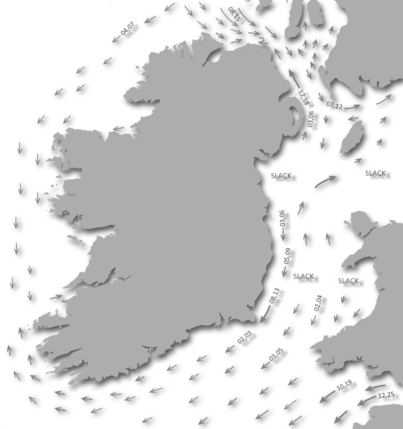
.- The direction and velocity of the tide should be the central feature of any navigation planning on this corner of Ireland as covered in Rathlin Island's Church Bay
 entry.
 - Locate Portrush’s conspicuous North Pierhead, FlR3s6m3M, and head towards it.
- On closer approaches, come south until it is well open and track in on the leading line of 028° T, occasional fixed blue at night, two orange triangular shapes by day.
- Do not drift south of the leading line of 028° T as it shallows quickly near the entrance.
- Give the head of the North Pier a wide berth as a sunken breakwater extends about 20 metres southwest from it.
Not what you need?
- Seatons Marina - 3.5 nautical miles SSW
- Coleraine - 3.8 nautical miles S
- Portballintrae - 3.8 nautical miles E
- The Lower River Bann - 3.9 nautical miles SW
- Portbraddan - 8.7 nautical miles ENE
- Portnocker - 9.2 nautical miles W
- White Bay - 9.3 nautical miles W
- Portkill - 9.5 nautical miles WNW
- Cornashamma Bay - 10 nautical miles W
- Ballintoy Harbour - 10.2 nautical miles ENE
- Seatons Marina - 3.5 miles SSW
- Coleraine - 3.8 miles S
- Portballintrae - 3.8 miles E
- The Lower River Bann - 3.9 miles SW
- Portbraddan - 8.7 miles ENE
- Portnocker - 9.2 miles W
- White Bay - 9.3 miles W
- Portkill - 9.5 miles WNW
- Cornashamma Bay - 10 miles W
- Ballintoy Harbour - 10.2 miles ENE

Chart

What's the story here?
 Portrush Harbour as seen from the head of the North Pier
Image: Michael Harpur
Portrush is a busy holiday town saddling the promontory of Ramore Head and the shoreline of Portrush Bay. The main part of the old town, including the railway station as well as most hotels, restaurants and bars, is built on a nearly ¾ mile-long peninsula and it has a population of about 6,500 people. The town has a small harbour protected by two substantial breakwaters that cater for commercial fishing vessels, small yachts and angling boats. The harbour lies close south of Ramore Head and on the west side of the promontory facing Portrush Bay.
 Portrush Harbour's pontoon that lies alongside the North Pier
Image: Michael Harpur
Portrush Harbour receives visitor craft at its 75-metre-long pontoon that lies alongside the North Pier. It can receive vessels of up to 48.8 metres LOA carrying draughts of up to 3.00 metres LAT but there is a minimum of 2 metres depth in the entrance at LWS. Vacant moorings, bow and stern, may also be available in the harbour area by arrangement with the Harbour Master. Portrush Harbour Office and the clubhouse of Portrush Yacht Club are immediately above the pontoon on the North Pier.
 Portrush Harbour Office and the clubhouse of Portrush Yacht Club
Image: Michael Harpur
Space is however limited and it is advisable to make arrangements during office hours with the Portrush Harbour Master in advance
 Ch. 12, [Portrush Harbour],
  +44 (0)28 7082 2307,
  +44 (0)788 908 1860,
  portrushharbour@causewaycoastandglens.gov.uk with more details available on their website
  .
.  Local boats moored, bow and stern, in the harbour area
Image: Michael Harpur
The harbour is small, very busy and subject to congestion so consider this a short-stay location. It would be difficult to leave a boat unattended here for an extended period. A slightly uncomfortable swell may be felt alongside the pontoon in westerly conditions where the Harbour Master will offer the best advice. The welcoming Portrush Yacht Club might also be contacted as follows
+44 (0)28 7082 3932, info@portrushyachtclub.com with more details available on their website .  Cruise ship anchored in Portrush Bay
Image: Tourism NI
It is also possible to anchor outside west of the North Pier but not the area southward of the South Pier which is shallow. This is not suitable in strong west or northwest winds.
How to get in?
 Ranmore Head and The Skerries
Image: Tourism Ireland
 Offshore details are available in northeast Ireland’s coastal overview for Malin Head to Strangford Lough . The direction and velocity of the tide should be the central feature of any navigation planning on this corner of Ireland and these are covered in Rathlin Island's Church Bay entry.
 Benbane Head
Image: Tourism NI
 Vessels approaching from the east should keep at least 1 mile offshore of Benbane Head to avoid a formidable tide race that exists off the headland. Those hugging the shore should make note of the Mile Stone about 160 metres off of Runkerry Point before crossing Bushmills Bay. Portballintrae is then readily identified from seaward by its modern housing development. It is conspicuously the only tight grouping of housing along the coastline between Portrush and Ballycastle. From Portballintrae, there is then a choice of approaches to circumvent The Skerries and make an approach on Portrush.
  The horseshoe shaped Portballintrae Bay and Bushmills Bay adjacent
Image: Michael Harpur
The Skerries are a chain of low rocky islets located 1 mile out from the shore. The group’s western end is located a ⅓ of a mile northeast of Ramore Head from which they extend for 1½ miles in an easterly direction. The largest islets are Great Skerrie, which is about 200 metres across and 25 metres high, whilst little Skerrie is only 15 metres high. The choice is either to pass to the south of The Skerries, between and the shoreline, through Skerries Roadstead and then Skerries Sound, or, to pass out to the north side of the group and continue outside to seaward of them.
 The Skerries
Image: Michael Harpur
Coastal cruisers will find ample water in the passage through Skerries Roadstead, between the group and the mainland, and Skerries Sound, between the Carr Rocks and the Ranmore headland, making it a convenient and interesting approach to Portrush. Although tides may be disturbed on either side of the Skerries it sets fair through the Sound that is free from outlying island dangers. Vessels can even obtain a sheltered anchorage, during the summer, within Skerries Roadstead.
However at night, this approach has no lit marks and in poor weather, a heavy sea can be experienced within this narrow passage, especially so at the narrower western end of Skerries Sound, where strong tidal currents and overfalls are often encountered. In all these cases, and in limited visibility without the benefit of an experienced local boatman aboard, it would be best to avoid the unnecessarily narrow channel and approach Portrush from outside the Skerries.
 The Storks as seen from the shore
Image: Michael Harpur
Those taking the inshore route should identify The Storks which is the key Skerries Roadstead mark. It is situated on the eastern entrance to Skerries Roadstead, 2½ miles from Ramore Head and the sea breaks heavily upon it in any swell. The Storks is an isolated rock patch that dries to 2.1 metres. It is steep-to on its northern side with 13 metres of water found 100 metres from the mark. The south and east side has foul ground that extends out 100 metres. The Storks beacon is a conspicuous red conical metal beacon, ball top mark, 11 metres in height that lies 0.6 of a mile offshore. Although unlit there is a lighted (Q) North Cardinal Buoy moored 200 metres north of The Storks. Keeping at least 250 metres out from its beacon clears all dangers.
 The Storks as seen from Dunluce Castle area
Image: Michael Harpur
Vessels approaching from the northeast may use the Admiralty Chart 2494 line of bearing of 219° T of the conspicuous Ballywillan Church tower. This leads through the middle of the 1-mile wide passage to the northwest of The Storks Beacon and to the southeast of Black Rock - the easternmost of the Skerries. In the middle of the Skerries Roadstead The Storks Beacon provides an eastbound line-of-bearing of 083.5° T, westbound 262.5° T astern, that leads through the central Skerries Roadstead and Sound. Here it is simply a matter of tracking along the line of bearing with plenty of water on each side. With the exception of the Stork Rocks, the area between The Skerries and the shore is free from danger.
 Yacht approaching through Skerries Roadstead
Image: Michael Harpur
Coastal cruisers passing along the mainland shore can also pass south of The Storks. There is a ½ mile-wide channel between the southernmost danger of The Storks with up to 11 metres of water. This is a pleasant passage with no outlying dangers and plenty to see ashore.
 The inshore route to Portrush off The White Rocks and Curran Strand
Image: Tourism Ireland
Most notably, a little over 1 mile to the west of Portballintrae, at the end of a line of mainly black rock basalt cliffs that rise and stretch eastward from the small village, stands the magnificent ruins of Dunluce Castle. Perched on the summit of a rocky outcrop the prominent castle overhangs the sea and is approached from land by a narrow causeway over a stone bridge, whilst underneath the castle is a particularly beautiful cavern.
 White Rock Bay exposures on the inshore route
Image: Michael Harpur
West of the castle, to the south of The Storks, the limestone cliffs of White Rocks Beach commence. The powerful dumping waves have carved this coastal limestone into caves and huge sea sculptures with interesting names such as the Elephant Rock and the Lion's Claw. The last ¾ of a mile to Portrush is a range of sand hills.
 White Rocks from seaward
Image: Tourism NI
The narrowest point of both these approaches is at the exit in Skerries Sound. Skerries Sound leads between Ramore Head and the southwest end of the chain called the Carr Rocks. The navigable fairway here is only 180 metres wide and its currents attain speeds of up to 2.5 knots. Although the centre is clear of danger and has depths of up to 14 metres of water, attention must be paid to two dangerous sunken rocks that skirt each side.
 The last ¾ of a mile of sand hills leading to Reviggerly Reef
Image: Tourism NI
The first is the Reviggerly Reef on the south side. This is a shelving partially-exposed rocky reef spur that extends 50 metres into the Skerry Sound from the east part of Ramore Head.
 Ranmore Head, Carr Rocks and The Skerries
Image: Michael Harpur
Then opposite, on the north side of Skerries Sound, are sunken Carr Rocks that mark the western end of the Skerries group. Situated 400 metres northeast by north of Ramore Head they uncover at half-tide and are always visible by the break on them. The southwesternmost corner of the group is Big Carr dries to 0.9 metres. It is situated under 100 metres to the southwest of the tiny islet of South Island Ean which is 5 meters high.
 The Carr Rocks on the north side of Skerries Sound
Image: Michael Harpur
The northern sunken Carr Rocks are of particular concern as the bay’s east-going tide sets strongly towards Ramore Head, across the entrance of Skerries Sound and onto these covered rocks. The safest option, travelling either way, is to tend to the southern side of the Skerries Sound where the reliably visible, and partially-exposed, Reviggerly Reef is situated off the steep-to Ramore Head.
 Ranmore Head with Inishowen Head in the backdrop
Image: Tourism Ireland
 Vessels approaching from the west or northwest will find few hazards to the west of Portrush as far as the entrance of Lough Foyle. From Lough Foyle, the shoreline is composed of rocky precipices rising to Mount Benevenagh’s 396-metre summit a short distance inland. The entire coastline is fronted by a low sandy beach extending 9 miles from Magilligan Point. With the exception of the Tuns Bank, extending 3 miles northeast from Magilligan Point at the Foyle entrance, this passage is clear of any danger save for the shoaling beach. There are some outlying rocks after Portstewart, but there are no hidden dangers beyond a ¼ of a mile from the shoreline. A berth of at least 600 metres will keep a vessel well clear of dangers.
  Portrush Bay
Image: Michael Harpur
The principal headland encountered after Portstewart is Ramore Head and Portrush Bay lies between these heads with Portrush Harbour clearly visible throughout the entire bay. Portrush Bay shoals gradually inwards towards Mill Strand which forms its head. It is clear of dangers except on its west side. The 7-metre-high Island Doo lies 200 metres out from the shore. It has The Moat, a half-tide rock drying to 1.2 metres, situated about 200 metres further to the west of it. Westward of the moat are some sunken ledges extending about 200 yards offshore.
 The approach to Portrush Harbour
Image: Michael Harpur
 From the Initial Fix, the harbour is entered between the heads of North Pier and South Pier on each of which stands a light. The North Pier: FlR3s6m3M is visible 220°-160° T and the South Pier: FlG3s6m3M and is visible 220°-100° T. Leading marks are provided bearing 028° T, occasional fixed blue at night (but these are normally only switched on for lifeboat use), two orange triangular shapes by day.
  The entrance to Portrush Harbour as seen from the North Pier
Image: Michael Harpur
The North Pier light and those within the harbour make a night entry easy but expect to find some difficulty to pick out the navigation lights from the town lights behind. The helm should not drift south of the leading line as water shallows quickly on this side of the leading line when close to the entrance and particularly so in the last 100 metres. In all cases, once the entrance has been identified, come south until it is well open before turning northeast to track into the harbour.
Care is required in the final approach to the harbour entrance itself. The north pier should be given a wide berth as a sunken breakwater, with 0.6 metres of cover, runs out about 20 metres to the southwest from the pierhead. In robust conditions expect a groundswell to run across the entrance.
 The pontoon alongside the North Pier and the moorings in the south side of the
harbour
Image: Michael Harpur
Once through the entrance take a central route up through the harbour and come alongside the southern end of the pontoon or as prearranged with the Harbour Master.  Portrush Harbour's pontoon
Image: Michael Harpur
Vessels anchoring should carefully check the chart for the location of the undersea cable that passes out northwestward from the beach about 300 metres outside of the harbour.
Why visit here?
Portrush derives its name from the Irish 'Port Rois' which aptly means 'the landing place on the promontory' or 'port of the promontory'. Ranmore Head form made an ideal location to fortify and have a small port
 Image: Michael Harpur
Portrush's history of human habitation goes back to 'Larnian'; the late Irish Mesolithic period. A number of flint tools were found here in the late 19th century that have recently been dated to around 4000 BC. Set on the Ramore Head promontory the site would have provided excellent natural defence. To underscore this the headland name of Ramore is derived from the Irish 'Rath Mhor' meaning 'big ring fort'. As such the Portrush settlement would have established itself beside a pre-existing promontory fort.
 Ranmore Head as seen from the head of the North Pier
Image: Michael Harpur
The current town began as a small fishing settlement that grew around a Norman Castle known as 'Caisleán an Teenie' in the 12th or 13th century. This castle was believed to have been sited at the tip of Ramore Head and it had a church close by. The takings of the church, as detailed in the 1306 records of the papal taxation, were very good and by extension, the settlement must have been wealthy. This most likely was because Portrush was an active little port with fishing boats and trading links to Scotland. It is believed the Norman Castle was destroyed in the late 16th century and no trace of it nor the church can be found today. Another castle, 'Portrush Castle', was believed to have been built in the town early in the 17th century around the time of the Plantation of Ulster. Again nothing survives of this structure, but in its day after the Wars of the Three Kingdoms, between 1639 and 1651, Portrush had been well established as a small fishing town.
 Portrush acquired its elegant terraces of Georgian houses during its seaside
resort days
Image: Michael Harpur
Portrush would take off in the 19th century following the industrialised post-railway holiday boom. Following the opening of the Ballymena, Ballymoney, Coleraine and Portrush Junction Railway in 1855, thousands came here to enjoy North Antrim's landscape and scenery. By the end of the 19th century, the Causeway Stones had become an important tourist attraction. They had been well documented in contemporary literature and visited by many famous travellers including Sir Walter Scott and William Thackeray.
 White Rocks Beach
Image: Tourism NI
Portrush, 12km from the site, was the popular Victorian seaside resort and the starting point for many visitors to explore the area by jaunting car. It was an ideal location as it had of itself three sandy bathing beaches; the West Strand, East or Curran Strand and White Rocks which remain to this day among the finest beaches in Ireland.
 White Rock Bay sea arch
Image: Tourism NI
It was during this period Portrush acquired its elegant terraces of Georgian houses that reach out along the mile-long peninsula towards Ramore Head. Within this stretch is the main part of the old town is situated including the railway station as well as most of the hotels, restaurants and bars. The Royal Portrush Golf Club opened in 1888 and Portrush Yacht Club was established in 1894. By the turn of the 20th century, Portrush had become one of the major resort towns of Ireland, with several large hotels and boarding houses including the prominent Northern Counties Hotel. These were the town's seminal years, the late 19th and early 20th century, and the town declined when foreign travel began after the Second World War.
 The Giant's Causeway Tramway
Image: National Library of Ireland on The Commons
Most remarkably amidst the heights of the tourist boom, Portrush was the site of the innovative and first long-distance hydro-electric tramway in the world. The Giant's Causeway Tramway's initial section opened from Bushmills to the Giant's Causeway in 1887 and the 9¼ miles from Portrush was directly connected to the Giant's Causeway in 1893.
 The Giant's Causeway Tramway at Dunluce Castle
Image: Public Domain
Today Portrush carries forward its seaside Victorian legacy and is one of Northern Ireland’s most popular family holiday destinations. The resort town bursts at the seams with holidaymakers in the high season, especially so on bank holiday weekends and it also runs special events throughout the year. As such many of its attractions are focused unashamedly on good old-fashioned family fun. It has a variety of eating-out options with restaurants, gastro pubs, cafes and hotels, and has all amenities a popular holiday resort demands.
 The Royal Portrush Golf Club
Image: Tourism NI
The town is also one of Ireland’s top surfing centres. Portrush usually hosts the Portrush Open Irish Surfing Association competition at Easter, but dates can vary depending on weather conditions. It is also home to the North’s most prestigious golf club, the renowned Royal Portrush Golf Club situated on the peninsula hosted the 2019 British Open Championship. As such the town offers a host of activities for all the family and it is an especially good location for younger family members. The safe harbour also makes it a base from which to visit surrounding attractions.
 Dunluce Castle less than three miles east of Portrush
Image: Tourism NI
Well worth visiting in the immediate area is Dunluce Castle which is situated on the coast three miles east of Portrush south of the Storks. Dramatically crowning a 100-foot-high basalt-rock crag and overlooking the sea Dunluce was undoubtedly one of the very best natural sites for a promontory fort, and its cliffs removed the need for any defensive ditches. Even roofless, this shattered bulk conjures up a strength and aura that is quintessentially Antrim. It is one of the north’s most evocative ruins and is thought by many to be the most picturesque and romantic of Irish castles.
 Crowning a high basalt rock Dunluce is a natural site for a promontory fort
Image: Tourism NI
A pleasant walk is available to it by the coastal footpath Port Path (part of the Causeway Coast Way) the 23 km / 14.3 miles leading between Portstewart and Portrush and along Curran Strand to Dunluce Castle. Returns by a quiet country road with splendid views over Portrush. The Skerries seen offshore along the way, where it is possible to anchor, are an important habitat for a large population of breeding seabirds of which several bird species are unique. Interestingly the islands have their claim to fame as a footnote in geological history. Formed from cooled volcanic lava, geological evidence from this outcrop was pivotal in proving the theory that basalt is formed from cooled volcanic lava. The world-renowned Giants Causeway, 10 miles from Portrush, Old Bushmills Distillery, & the Carrick-a-Rede Rope Bridge are also located nearby making the visit very worthwhile.
 The Harbour Bar is a reliable refuge in a bad spell of weather
Image: Tourism NI
From a boating perspective, Portrush Harbour is a very useful resource. Easily accessed and adjacent to the main sailing fairways of the north coast, it takes little time to drop in. Likewise, it is a perfect staging location to set up 25 miles westward run around Malin Head, or 20 miles eastward around Fair Head. Provisioning and transport links are all excellent from here.
 Portrush Harbour is an ideal passage markers harbour with many added benifits
Image: Michael Harpur
But there would be no reason to leave hastily as it is a great berth from which to enjoy the area. A short stroll from its secure picturesque harbour, are restaurants, wine bars, and cosy pubs. From its every point, there are views out over beautiful sandy beaches with panoramic views over the ocean to the Causeway Coast, Scotland and the hills of Donegal. Add to this a wide range of activities for younger folk and the aforementioned attractions of the wider area with good transport links and there's something for everyone aboard at Portrush.
What facilities are available?
The pontoon offers water and fuel, and arrangements can be made to dispose of waste from on-board waste tanks. Fresh provisions including gas and a launderette can be obtained from the sizeable town which serves a population of about 6,500 that expands considerably during the summer. Portrush Yacht Club has showers and is located in a modern building adjacent to the Harbour Office on the quay. Visitors will find its members very welcoming. A slip plus a good beach for scrubbing can be found inside the harbour.Portrush is a busy and friendly holiday town with all the pubs, good restaurants, wine bars and cafe resources you would expect. Its railway station is the last stop on the Coleraine-Portrush line, where travellers can connect with trains to Derry, Belfast and beyond. Translink run a regular bus and train service to and from Portrush. The nearest airport is at Aldergrove 77 km.
Any security concerns?
Never an issue known to have occurred to a vessel in Portrush and the pontoon is a secure area. However this is a seaside resort that gets particularly busy in the season. The below user comment should be considered before planning a visit.With thanks to:
Terry Crawford, local boatman of many decades.Aerial views of Portrush Harbour


Add your review or comment:
Robin Anderson wrote this review on Jan 23rd 2012:
Sadly, Portrush Harbour has been disgracefully neglected by the Local Authority with no investment in the Harbour for many, many years. The needs of boat owners and visiting yachtsmen are totally ignored. The Harbour Masters have been excellent but are totally unsupported in their work. There have been serious security problems in recent years from young yobs stoning visiting yachtsmen , boarding and damaging visiting craft. Moored boats have been cast adrift by louts who visit the harbour after getting tanked up in the local hostelries. The Council appear content to give over the harbour to drunks and yobs and have no regard to boat owners. Motorists who are too lazy to walk from the nearby huge public car parks are allowed to park all over the harbour access area. A great shame - so moor with chain and keep a close watch on your boat here as rest assured that the Local Council has no interest in supporting the harbour as a place for boats!
Average Rating: UnratedJim Williamson wrote this review on Jun 16th 2012:
Fortunately, our visit was good though the above comments may well be justified. Toilet and showers were adequate if not fancy. Angus Barry the harbourmaster was very friendly and helpful. The pubs were certainly busy on the Friday night of our visit but there were no incidents and no noise after about 10.30pm. The Viking laundrette 68 Causeway Street 028 7082 2060 did an excellent serevice wash.
Average Rating: UnratedRobin Anderson wrote this review on Dec 5th 2013:
Pleased to report some welcome improvements to the Port in summer of 2013 with more control over access to the quay and improved facilities - well done the Harbour staff - hope the Council can be persuaded to invest further.
Average Rating: UnratedRobin Anderson wrote this review on May 26th 2016:
Delighted to report a complete turn around at Portrush. The harbour is now once again a great place for boats and boaters. Security has been much improved, a barrier keeps cars off the harbour area unless attending to boats, new pontoon with water taps down on the pontoon and shore power soon to be hooked up, excellent re-furbished toilet block with key code access for boat crews, total re-furbishment of Portrush yacht club, fire fighting and lifesaving kit on the pontoon - all in a complete transformation and a great credit to those who have put all the investment of time effort and money in. Portush is now properly on the chart again for visiting yachts and boats.
Average Rating:
Hugh Burgess wrote this review on Jul 11th 2019:
Preparing to arrive at Portrush with my 35’ Keri-D from Carrickfergus. Very informative comments from Robert Anderson, covering concerns that I had with regard to sleeping whilst berthing through the British Open week.
Very useful forum, and the photographs of the pontoon along the harbour a good reminder of the berthing facility.
Thank you.
Please log in to leave a review of this haven.
Please note eOceanic makes no guarantee of the validity of this information, we have not visited this haven and do not have first-hand experience to qualify the data. Although the contributors are vetted by peer review as practised authorities, they are in no way, whatsoever, responsible for the accuracy of their contributions. It is essential that you thoroughly check the accuracy and suitability for your vessel of any waypoints offered in any context plus the precision of your GPS. Any data provided on this page is entirely used at your own risk and you must read our legal page if you view data on this site. Free to use sea charts courtesy of Navionics.